Showing posts with label flooding. Show all posts

Monday, October 29, 2012

10/29 - 3:30pm - Superstorm Sandy Coming in, Cool Week in Mississippi

Hurricane Sandy is a monster storm. That goes without saying. It's about two hours from landfall as of this writing but that won't matter much due to just how incredibly large the wind field is. Tropical storm winds extend for hundreds of miles from the center of the storm making this the largest hurricane ever recorded in the Atlantic Ocean at over 1,000 miles wide. This is big by area, not by wind speed. While the winds extend for an incredible area the winds in general are at Category 1 speeds near 90 mph. For areas in the tropics this may not sound so bad but for the Northeast this is a disaster since winds rarely get up to that strength with storms up there.

Something that also may be unprecedented here is the extreme snow threat from Sandy for the mountainous regions of West Virginia, Virginia, North Carolina, Tennessee, and Kentucky. Snow totals could be 1 to 2 feet in places when this storm is said and done. The other thing to consider with the size and scope of this storm is the storm surge that continues to roll in. Places like New York City and along the Jersey shore could be dealing with storm surge totals in excess of 11 feet thanks to the pure mass of water that will be coming in with the storm. This will create coastal flooding whereas the high rain totals will contribute to inland flooding. You'll hear about this storm for years to come... 765,000 customers are without power across the Northeast already and this storm is just cranking up.

How is this storm affecting us here in North Mississippi? We're just seeing cooler weather thanks to the large trough of cold air that's in place. This trough is the same one that's ingesting Sandy making it a very unique storm and pulling it into the Northeast. This cooler air is going to be sticking around for the foreseeable future but with some moderation. Highs won't get out of the lower 60's tomorrow and we'll finally break into the upper 60's on Wednesday for Halloween. Overnight lows tonight will be of concern since they'll be getting close to freezing, which will create a chance for some frost. Your complete Starkville forecast with these details and more are available in the video below!

Saturday, December 3, 2011

12/3 - 2:45pm - Batten Down the Hatches, Heavy Rain is Coming!

West Tennessee and North Mississippi are going to be inundated with heavy rainfall starting tomorrow and lasting through Tuesday. The HPC's latest 12z rainfall forecast (right) has over 5 inches of precipitation in portions of Northwest Tennessee by the time this is all said and done, but amounts of 2 inches and over will be quite common across the area. Flooding will no doubt be a concern since this rain will fall on already saturated ground in a relatively short period of time (mostly Sunday and Monday), so the National Weather Service has issued a Flood Watch for the entirety of West Tennessee for Sunday morning through Monday night. The Tennessee and Mississippi Rivers will have to be watched during this, along with those low-lying areas that usually flood during these kinds of heavy rainfall events. After the rain and accompanying cold front move through, cooler temperatures and dry weather will be the rule for Wednesday and the remainder of the week. Check out my complete forecast on WBBJ this morning below for all the details:

Sunday, September 4, 2011

9/4 - 12:30pm - Yesterday's GMWT Video, TS Lee Update

Yesterday we began airing Good Morning West Tennessee for an additional hour starting at 8am. This means the Saturday show is now two hours, from 6-7am and again at 8-9am with Good Morning America airing in between. The forecast for West Tennessee still looks very wet today into tomorrow because of Tropical Storm Lee, but I think the rain should clear out as Labor Day rolls along. Check out some video from yesterday's broadcast below:


Lee is just hanging on to tropical storm status and should be downgraded to a depression later today as it moves inland. Just because it's weakening doesn't mean the risks from it will go away. Portions of Central Mississippi (I'm talking to you Starkville), Alabama, and even up through the Appalachian Mountains in North Carolina could see over eight inches of rain between now and Tuesday. Flooding is obviously a concern, so use caution while driving in these areas. Turn around, don't drown!

Tornadoes are also continuing a problem with Lee. There were 10 reports of tornadoes yesterday, some causing damage, along the Gulf Coast from Louisiana to Florida. Two tornado watches are in effect with about a half dozen warnings in them from Mississippi to Florida. The tornado risk from Lee should lessen as it continues to come onshore tonight and tomorrow.

Saturday, March 5, 2011

3/5 - 2:45pm - Heavy Rain Across West Tennessee

A Flood Watch remains in effect for West Tennessee until midnight and Flood Warnings have been posted for areas in extreme West Tennessee that have had some hefty rainfall totals this morning. All the heavy rain in the region is now coming to an end as a cold front moves eastward, bringing with it some cooler air and more stable weather. Check out my video below for all the details:

Monday, May 3, 2010

5/3 - 3pm - Flooding, Late Week Severe Weather, Storm Chasing

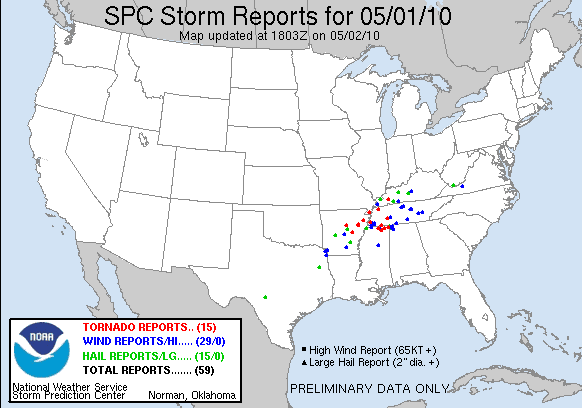
The rain that caused massive flooding in Nashville and elsewhere around the Southeast is finally out of here. The pictures coming out of Nashville, where 13.53" of rain fell at the airport this weekend, are just incredible, including this shot of the now-evacuated Gaylord Opryland Hotel and Convention Center:

(Photo Credit: Erin Davison)

More flooding problems could be on the way for areas on Nashville on the Cumberland River as it crests this afternoon. The death toll from this weekend's storms and flooding across Tennessee, Kentucky, and Mississippi stands at 21.

As this weekend's weather event wraps up, we now turn to later this week in the Ohio Valley. The Storm Prediction Center put all of Kentucky, Indiana, Ohio, and West Virginia, along with parts of Michigan, Tennessee, Illinois, Missouri, and Pennsylvania in a 30% risk for severe weather on Friday:


Here's what the SPC is saying about this event on Friday:

IT STILL APPEARS THAT A STRONG WIND FIELD WILL OVERSPREAD A MOIST AND UNSTABLE WARM SECTOR IN PLACE OVER THE OH VALLEY INTO LOWER GREAT LAKES.  HERE...ENVIRONMENTAL PARAMETERS WILL BE QUITE OPTIMAL FOR SUPERCELLS AND/OR A LARGE-SCALE LINEAR CONVECTIVE SYSTEM WITH THE THREAT FOR WIDESPREAD SEVERE WEATHER.

The GFS model seems to support these assertions with ample shear and the presence of upper-level divergence on the 500mb chart (causes uplift in the atmosphere... crucial for storm development):

The NAM model will chime in on this event tomorrow, which means we will have a better handle on what kind of instability and winds we'll be dealing with. I will say that moisture will not be a limiting factor for severe weather on Friday as dewpoints will most likely be in the 60's. There could be a few severe storms around the area on Thursday and Thursday night as the cold front with this system approaches the area, but limited shear will keep a lid on that potential.

The ironic thing about this Friday severe weather is that I'm leaving for Amarillo the next day to start my storm chasing trip. The start of the tornado season in the Plains has been very slow because of limited Gulf moisture, but now that temperatures in the Gulf have risen, I think things will begin to pick up pretty quickly. This week will be fairly quiet due to a west-east zonal flow across the US, but next week a disturbance in California will bring back the much-needed southwest winds to the Plains. Here's what the GFS is putting out for May 10th (my second day of storm chasing) in terms of instability and moisture:

Notice how the CAPE (instability) goes well over 2000 J/kg on the TX/OK border in the image on the left and how dewpoints will be approaching the 70 degree mark in the image on the right. These two factors are very good for severe weather in both TX and OK, so our Todd (our tour leader at Storm Chasing Adventure Tours) and I are really going to have to watch the development of this situation as next week approaches. Storm Chasing Adventure Tours started the first tour of the season yesterday by driving from Amarillo, TX to Meridian, MS to see some severe storms around South Mississippi. Even though the zonal flow this week won't be conducive for any widespread severe weather, I'm sure it'll be a fun tour. I'll be out there on Tours 2-5 (May 8th - June 5th), so don't forget to check out the blog for videos, pictures, and updates!

Sunday, May 2, 2010

5/2 - 3:15pm - Storm Chasing & Too Much Rain!

In exactly one week from today, I'll be on the road with Storm Chasing Adventure Tours looking for supercell thunderstorms in the Plains! After a busy week of packing and preparation, I will leave for Amarillo, TX on Saturday to meet up with the group. Right now the pattern is not indicating any type of severe weather outbreak in the Plains over the next couple weeks, but there may be some isolated activity that could produce a tornado or two. Since I'm going to be out there from May 8th to June 5th (a full month!), there will be plenty of time for conditions to change and possibly generate some good tornado outbreaks. Don't forget that I'll be posting HD video, pictures, and chase reports right here on the blog. We will begin streaming LIVE video when I begin chasing next Sunday on Storm Chaser TV. The excitement begins soon!

Turbulent weather has been prevalent across the Southeast over the past 24 hours. Last night featured quite a few supercells in Arkansas and a strong one that grazed the Memphis area, causing the evacuation of the Beale Street Music Festival. There were 15 reports of tornadoes in North Mississippi, West Tennessee, Arkansas, and even one in West Kentucky yesterday. Two more tornado reports came in this morning from South Central Kentucky as well. Flooding was an even bigger issue yesterday and still today as well throughout Central Tennessee. Southwestern sections of the Nashville area have received over 11 inches of rain over the past 24 hours according to the National Weather Service:


Parts of I-24 and I-40 around Nashville are closed due to flooding and 6 people were killed as flood waters rose last night. Heavy rain is still falling in Nashville at this time and won't end completely until early tomorrow morning.

Over 2" of rain has fallen in Louisville this morning, with some areas in the Metro getting over 4" of rain already. My rain gauge here in Southeast Louisville is indicating 2.27" of rain since midnight and 3.69" for the whole rain event since yesterday. Needless to say, flood waters are rising around town and we're under a Flood Watch until 5:30pm. Some roads in the South end of town, where the most rain has fallen, are under water. Be careful and don't drive into flood waters if you're traveling around Louisville today!

Saturday, May 1, 2010

5/1 - 11am - Kentucky Derby & Severe Weather?

It's the first Saturday in May and we all know what that means in Louisville: The Kentucky Derby! The rain is still falling here, but I think we may catch a break around lunchtime and the sun may even come out. We'll see more rain after that brief clearing, but the latest RUC computer model runs are indicating another break in the rain around 6pm, when the Derby will run.

Severe weather has been a big issue to our southwest over the past 24 hours, but the Louisville area may see a few severe storms this afternoon and evening, especially if the sun comes out after the rain breaks this afternoon. Heavy rain will be making its way back into the region tonight, when we could have some flooding problems in the Ohio Valley. To the right is the expected rainfall estimate for today and tomorrow from the Hydrometeorological Prediction Center, which shows Louisville getting over 6" of rain.

A rare High Risk of severe weather has been issued for parts of Arkansas, Mississippi, and Tennessee today due to the threat of strong, long-tracked tornadoes. This is the third time in a week that a High Risk has been issued by the Storm Prediction Center. Tornado watches have been issued for these areas, including the region around Mississippi State University. This comes after last night's severe weather troubles in Arkansas, where tornadoes damaged homes and caused at least one fatality. Big time flooding is occurring in Memphis right now, with more rain on the way this afternoon and evening.

With all of this severe weather going on I nearly forgot that we are exactly one week away from the start of my month-long storm chasing trip! I'll be leaving Louisville on May 8th to go storm chasing with Storm Chasing Adventure Tours. Don't miss my blog posts and updates from May 8th to June 5th!

Monday, September 21, 2009

9/21 - 7:45pm - Rain, Rain, Rain!

Everyone in the Southeast is sick of rain after the last few days. From Louisville to Starkville, MS to Atlanta, flooding problems, heavy rain, and headaches have been all too common! Here's a video I shot this afternoon of some students here at MSU using skimboards in some of the minor flooding that occurred outside my residence hall:


We've had quite a bit of rain here at MSU, but flooding has really not been an issue. The rain in Atlanta over the past few days became deadly today as flooding caused deaths. Up to 20 inches of rain has fallen in some parts of Georgia. More rain is possible tomorrow around the Southeast, so there could be more flooding to come.
[11alive.com - Atlanta]

Tuesday, August 11, 2009

8/11 - 12pm - Severe Weather in Mississippi

The SPC has issued a SLIGHT Risk for a good portion of the southeast today:


CAPE values in central Mississippi right now are topping 4500 J/kg and storms are firing vigorously. Shear values are way too low to have a tornado threat here, but high winds and a bit of small hail aren't out of the question. Hopefully these storms can hold temperatures down this afternoon into the lower 90's instead of the middle 90's.

Looks like Louisville had more flooding problems yesterday with storms that came through the area. More storms are on the way for this afternoon up there, so they'll really have to keep an eye out for more flash flooding.
[Courier-Journal, NWS]

A typhoon that already caused havoc in Taiwan came ashore in China yesterday, causing one million people to be evacuated and numerous fatalities. A typhoon hit Japan yesterday as well, which caused landslides and fatalities.
[USA Today]

Thursday, August 6, 2009

8/6 - 11:30am - Tomorrow's the Day!

After a summer full of storm chasing, traveling, and wacky severe weather, it's finally time for me to travel to Mississippi State tomorrow for my first semester there. Move-in day is on Saturday, meaning all those boxes have to come out of the car and into my dorm room. The drive is fairly long (7-8 hours), but it should be fun and I hope that things will go smoothly!

The Louisville National Weather Service office has issued a regional map with 24-hour rainfall totals the morning after the flood:

You can really see how isolated the storm cell was that hovered over Jefferson County that morning. We were shocked to see that we only had .99" at the end of the day on our rain gauge here at home, but this map pretty much confirms that reading. The gym floor at my alma mater duPont Manual High School was flooded during this event, but luckily maintenance crews and administrators were on the scene to help reduce the amount of damage. Great job!

I also wanted to point out that we've just gone through the coolest July ever in the region. We usually have 12 days with 90 degrees or higher in Louisville during July, but this year we had none for the first-time ever. [Coldest July Ever Recorded in the Midwest/Ohio Valley - NWS]

Tuesday, August 4, 2009

8/4 - 9pm - Just Another Wacky Day in Louisville

Talk about some wacky weather, a surprise flood that damages millions of dollars worth of property, traps many in their vehicles, and knocks out power to thousands of residents. If you told me last night that we would break the all-time record for a one-hour rainfall today with 6 inches in places around the Metro, I would have told you to see a doctor. So, in the last twelve months we've had a record-breaking wind storm, record-breaking ice storm, and a record-breaking surprise flood. Is this really just another day in the wacky realm of Louisville weather?

Many are asking why, what happened? Why did this eastward line of storms this morning suddenly make a 90-degree southward turn over Southern Indiana and slam Louisville? My answer is about as clear as the one from the rest of the meteorological community at the moment: I don't really know. My guess would be something to do with the lower level jet, which is a rapid stream of wind a few thousand feet off the ground. This jet normally activates at night when there is little to no instability, meaning it can power late-evening thunderstorms with little interference from rising parcels of unstable air. The thunderstorms heading eastward this morning may have come in contact with or lost contact with the lower level jet this morning by some fashion and that may have made a difference in the direction they were moving. Technicalities aside, I've never seen a storm system take a sharp turn like that before and it was about as freak of an event as, say, a wind storm from the remnants of hurricane over Kentucky (oh wait a minute...).

Looks like we're going to see more rain in a few hours here in town, but I don't think it will be as heavy as the deluge we had this morning.

8/4 - 10:15am - FLOOD EMERGENCY

Louisville is under a Flood Emergency right now after inches and inches of rain fell this morning. Rain should end by around midday, but more storms are on the way for this afternoon. This is a very dangerous situation, especially in the Downtown Louisville area. Please do not drive into high water, and stay inside if you don't absolutely have to go out today.

Updates will be posted on my Twitter feed: twitter.com/ryan_weather

Friday, May 8, 2009

5/8 - 11:30pm - Severe Weather & Flooding Over

Our severe weather risk is officially over for the day and all flood-related watches and advisories have expired. The storm that caused wind damage to areas west of Evansville, IN weakened considerably before it arrived in Louisville, which prevented us from seeing any high winds. That's quite a relief!

Check back tomorrow afternoon for an updated video forecast!

5/8 - 5pm - High Winds!!!

High winds are coming into the Louisville area at around 5:30pm. Speeds near 100mph were recorded with this storm in Carbondale, IL and Evansville, IN recorded gusts near 80mph this afternoon. The good news is that the winds are weakening, but I still see potential for 50mph winds here in the next 30 minutes (5:30pm). To top that off, we're under a Severe Thunderstorm WATCH until 8pm.

How about all this rain!? All of the streams in my neighborhood are at capacity right now and I have a feeling that one or more of them will spill into the street soon. Cloud-to-ground lightning has been a major feature of this storm system, so be careful if you have to venture outside.

After the last batch of rain and wind comes through from the Owensboro area in a few minutes, we should clear out a bit, save for some scattered showers tomorrow morning. We should stay out of the rain until at least Wednesday with temperatures holding near 70 for highs.

Friday, March 27, 2009

3/27 - 4pm - Severe Storms Tomorrow

No blog updates until Monday 4/6/09.
No video or 7 day forecast updates until 4/11/09.
Have a happy and safe Spring Break 2009!

Since I won't be around to do a video forecast tomorrow, here's an updated 7 day forecast for next week:


The newest SPC severe weather outlook has upgraded much of Georgia to a 45% risk for storms tomorrow:


Areas 15% or higher are in a SLIGHT Risk for severe storms, and that 45% area will likely be a MODERATE Risk tomorrow morning. At any rate, a tornado outbreak is possible in the 45% area tomorrow as a shortwave with strong shear and decent instability comes through. I think we'll see some severe weather with a few tornadoes around the region tomorrow afternoon, but the main outbreak should be suppressed to the south. If by chance instability increases more than expected tomorrow with increased sunlight, we'll see more severe weather.

Right now, rain is coming up from the south and should be in Louisville within the hour. This will continue for a few hours this evening, but we should clear out completely by the early morning hours of tomorrow, if not before. This break will last until around 2-3pm, when clusters of severe storms start rolling through. Be sure to keep your weather radios on alert mode tomorrow afternoon and evening as this system comes through.

Evacuations are underway in North Dakota after the Red River broke a record level this morning. Sandbagging has been well underway for the last few days and residents are hoping the river does not go much higher. To read more, click here.

Monday, June 9, 2008

6/9 - 5pm - A Little Cool Down

91 degrees isn't my idea of a nice day. If you cut out some of the humidity, it probably wouldn't be so bad, but that's Kentucky in June for you. Tomorrow will be a welcome cool down day, with highs only reaching into the lower 80's and a little rain in the morning. Things will warm back up into the 90's by Wednesday, but it looks like we won't breach 92 this week. Next rain chance is on Friday.

Looks like we're going to be spared from any severe weather this week, but unfortunately some could make the flooding problems in Indiana go from bad to worse....

Still editing my storm chasing video!

Thursday, April 3, 2008

4/3 - 8pm - Less Rain... But Still Some Issues

It's with pleasure that I'm informing you that the cold front has setup shop south of the area, which shifts the core of the heavy rain down to Southern Kentucky. The radar shows some light shower activity in our area, with the bulk of the washout just north of Bowling Green. We've gotten .22" at my house and I think there will be 2 more inches, better than the up to 4" that was expected before the front settled in the south.

There will be some minor stream and river flooding here, but nothing compared to a couple weeks ago. Couple that with the lack of severe weather and I think you have a pretty benign system for the Louisville area.

It is also with pleasure that I inform you of our first 70 degree streak. From Sunday until at least Thursday we'll see temperatures hold in the 70's and just a spotty shower or two. Too bad I have to miss this pleasant weather coming up, because I'll be out of town!

Wednesday, April 2, 2008

4/2 - 9pm - Flooding Issues on the Horizon

Sorry about the gap between posts this week. This has been one of the busiest weeks this year for school, so bear with me. I'll also be gone next week to visit colleges as well, so there'll be a lull in content on the blog and site for the next couple weeks.

But now on to a potential flooding situation. We're looking at 2-4 inches of rain by Friday after a Thursday-Friday complex of rain comes through. With the ground still saturated, this surely won't sink in to the ground and go away on its own. If we get even more than the amounts projected today, this could be a very difficult flooding situation. We'll have to see.

And, if you didn't hear about this, Ken Schulz is retiring from WHAS11 TV in May. I personally met him for a shadow in January 2007, and he is just the nicest guy you'd ever meet. He will surely be missed along with meteorologist Jeremy Kappell, who is leaving the station as well.

Wednesday, March 26, 2008

3/26 - 7pm - Here Comes the Rain

There's a batch of showers and thunderstorms on the radar just west of here that will make its way in during the evening hours. The thunderstorm part is falling apart, but the rain is still there. After tonight's rain, things will temporarily clear out until Friday. We'll see more rain on Friday and then we get a break for the weekend, although temperatures will be about 10 degrees cooler than they were today.

Monday is a problem. We're going to get soaked from dawn to dusk, adding on some huge rainfall totals to what we will already had from later this week. The HPC thinks we're going to get an accumulated 3" or so of rain by Monday. This is obviously a problem since the ground is still saturated from last week's mess. Another flooding mess in the works...

Tuesday, March 25, 2008

3/25 - 5pm - Slim Severe Chance, Washout Coming

The SPC has issued a 5% severe risk for us on Thursday into Friday. While that isn't anything really, the rain looks more impressive on an impeding Monday system. The GFS is painting real dark shades of blue and green here, meaning the rains will be quite intense on Monday. I think that the flooding problem will rear its ugly head again with the rain from Monday and all days previous that see any rain (adding up to an inch or so prior to Monday).

Stay dry!