

Showing posts with label radar. Show all posts
Showing posts with label radar. Show all posts
Thursday, January 31, 2013
1/31 - 11:15pm - Snowy to Our North, but Clear Here!
Tuesday, January 29, 2013
1/29 - 5:45pm - Serious Severe Weather Concerns Tonight
Latest Severe Weather Updates
 A severe weather setup that we see normally in the springtime is about to unfold on this late January night across a large expanse of the Southeast. While not "unprecedented" or "once-in-a-lifetime", this outbreak is going to impact quite a few people and it's important that everyone have what they need to be prepared and safe. This post is mainly for folks in North Mississippi and West Tennessee, but you can figure out pretty well how you'll be affected if you're not in these areas by some of the maps and information below. Everyone needs to be aware of what's going on because this will be happening at a very bad time of night when even the night owls are asleep.
Fast Facts
 A MODERATE Risk of severe weather has been issued by the Storm Prediction Center for the overnight hours in West Tennessee and most of North Mississippi. Tornadoes, damaging winds, and hail are all on the table for these areas as storms move through. Even though places like the Golden Triangle in Mississippi are just outside of the Moderate Risk area I would treat this as if you were in it because these storms are going to be very, very strong still as they move through this region. Please, please, please have a weather radio or smartphone app that's armed and ready to alert you if a Tornado Warning is issued for your location tonight. This will be hitting when most people are asleep so it's a very dangerous situation.
Timing - North MS and West TN
8pm - Midnight - Small chance for some isolated storms. These would carry a tornado, wind, and hail threat.
Midnight - 2am - Slightly better chance for isolated storms, small line of storms may try to form ahead of main line.
2am - 7am - Main line of severe thunderstorms moves through. This will affect everyone. Tornadoes, severe damaging winds, and hail are a good bet during this time.
Discussion
 A line of storms stretches from the Great Lakes to Texas right now and will continue to move eastward through the evening. A few reports of severe weather have come in already from this but the main show will be overnight as this line of storms encounters a more rich environment for severe weather.
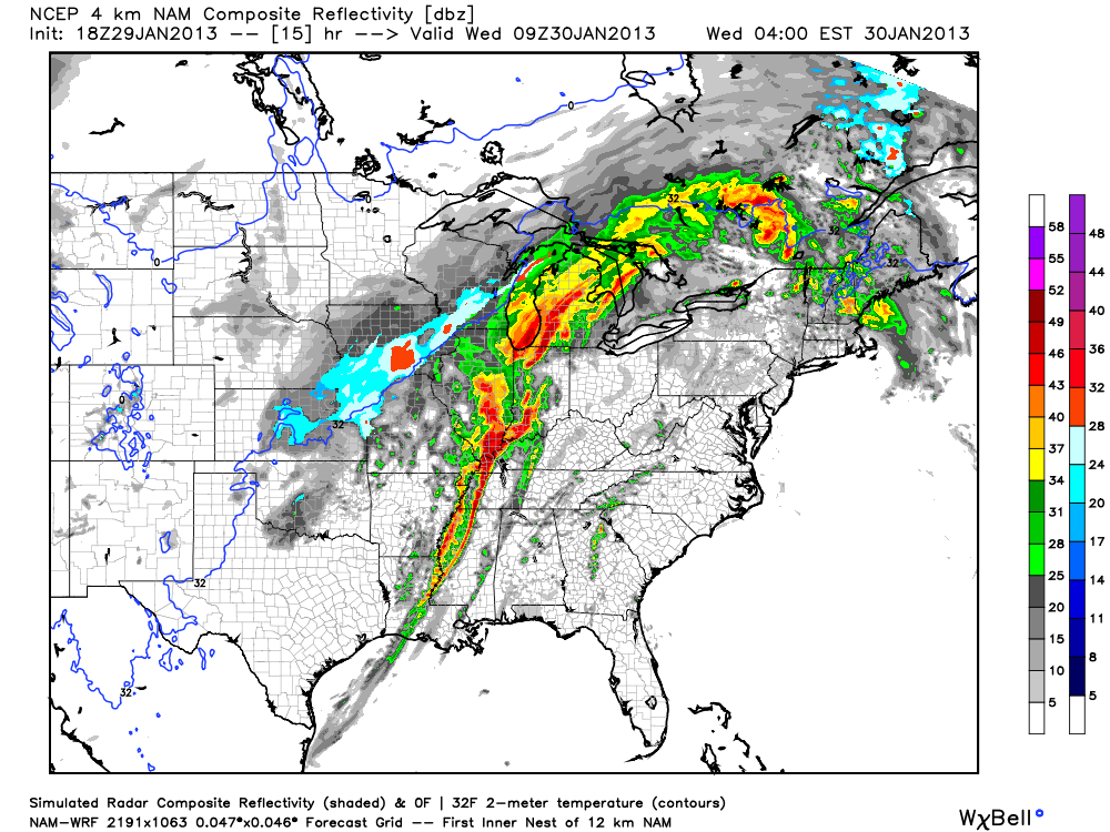 The main storm mode for tonight will be a squall line of storms with embedded rotation in portions of it (AKA what's termed a QLCS). Supercell storms will be possible ahead of the main line of storms too and could easily produce tornadoes if they develop. Tornadoes in QLCS lines of storms like the one we'll have tonight are more difficult to identify on radar since they're embedded within the line. While not as strong as supercell tornadoes, QLCS tornadoes can be strong and cause massive damage in the right environment.
 Also, since winds at 850 mb (about 5,000 feet) will be howling it will not take much for any part of this line of storms to pull these winds down to the surface and create straight-line wind damage. I wouldn't be surprised if folks affected by the worst of these winds thought they were hit by a tornado. I'm hearing the word Derecho being thrown around a bit with regard to how this system will develop tonight. That's certainly a possibility with this system but I think it's a relatively small chance.
Follow me on Twitter and my Facebook page for the latest updates tonight!
Sunday, December 2, 2012
12/2 - 4:15pm - A Needed Shot of Rain on the Way
 A few brief showers scraped across northern portions of West Tennessee this morning as expected. The disturbance causing those morning showers has left behind some cloud cover across the region with peeks of sun here and there. More of the incredibly warm weather that we've seen for the past few days arrives tomorrow just in time for the Jackson Christmas Parade at 6:45pm. 75 still looks like a good bet for a high temperature during the afternoon as we start the workweek on Monday.
 Much of the area is experiencing moderate drought conditions right now. Even though the growing season is pretty much over it is still important for rainfall to keep up so that we don't have an already-in-place drought come spring. The good news here is that we have a chance for a good soaking rain on Tuesday with over a half inch possible in most places. The front causing this rain will leave behind only slightly cooler temperatures in the 60's, which is still warmer than average for this time of year. The next round of rain on Friday and Saturday is the one to watch as it could bring much, much cooler weather to the area next weekend behind it.
Check out the video below from yesterday night's newscast on WBBJ for your full forecast!
Monday, November 26, 2012
11/26 - 2:15pm - Rainy Start to the Week, Severe to the Southwest

 Had enough of the rain in Starkville this morning and afternoon? Just wait, there's more! An area of moist air ahead of a cold front that will move through tonight is inspiring the development of numerous showers and those will eventually lead to some thunderstorms late tonight. Some of the storms to our southwest could be severe but it's looking more and more like we won't have quite enough moisture and instability to get that kind of storm activity closer to the Golden Triangle. A Slight Risk of severe weather has been issued for areas west of I-55 due to the possibility for severe storms toward Jackson and Vicksburg. Once the cold front sweeps through tonight it'll leave us with cloudy skies for a good chunk of the day tomorrow before things clear out for Wednesday and Thursday.
The weekend will feature some clouds and possibly a shower here and there but overall we'll be seeing one warm end to the month of November as temperatures get close to and surge past 70 degrees! Check out the video below for your detailed CampusConnect forecast.
Monday, November 5, 2012
11/5 - 2:15pm - Quick Shot of Rain on the Way in Mississippi


Full sunshine will return to Mississippi by Wednesday and temperatures will recover well into the 60's to 70 or better by the weekend. We'll be watching a storm system make its way through the middle of the country next weekend that has the potential to impact us on Monday of next week. It's not entirely clear how severe the storms we'll have will be but just keep in the back of your mind that we could be off to a stormy start next week. Check out the video below for your complete forecast for the Golden Triangle area.
Monday, September 17, 2012
9/17 - 2pm - Tropical Rains Overtake Mississippi
 Like heavy rain? Neither do I. That's what we have going on right now across most of Mississippi as an approaching cold front and a low moving onshore from the Gulf of Mexico are combining to give us a good soaking. The downpours and storms across the Golden Triangle area of Mississippi are definitely tropical in nature because moisture is streaming in right from the Gulf as the low pressure center out there continues to move our way. Storms will continue, and rain be at times heavier, this evening across the northeast quarter of Mississippi. Storms will remain likely tomorrow morning but thankfully the front will be moving through at that time and replace the rainy, tropical air with much more pleasant dry and cool air from the north. The middle of this week behind the front looks beautiful! Check out your full Mississippi State University CampusConnect forecast below for all the details on this week's forecast.
Like the new intro video and 5 Day Forecast background in the above forecast? I've been working on those graphics for the past few months and we're rolling them out today as we kick off the official start of our CampusConnect forecasts for the year here at MSU.
Sunday, September 16, 2012
9/16 - 2:40pm - Rainy Start to the Week in West Tennessee

If you watched the video you probably saw some changes from previous ones that I've posted. WBBJ debuted an all-new HD weather graphics system that has full 3D rendering capabilities. It's very slick, easy to use, and most of all, fun! The 3D zooms to Jackson's tonight and tomorrow forecast I built from scratch between shows yesterday and it was pretty amazing what the machine could do with so little time.
This is also my 2nd anniversary with WBBJ. A lot has changed since I started working there in September 2010 but one thing that hasn't changed is how much I enjoy doing shows there! Can't wait to keep going back there on select weekends during this school year.
Wednesday, September 5, 2012
9/5 - 11:35pm - Stormy Week, Cooler Weekend, and TV Tomorrow!


 Looking for something to do tomorrow night? On the Travel Channel at 10 pm/9c tomorrow night a show called Extreme Tours will be airing and the first segment of the show will feature me and my pals at Storm Chasing Adventure Tours! A crew from the show came out to film and interview us as we chased this past spring in New Mexico and their footage along with clips from my library of tornado video will be airing. This program will showcase what we do as a tour group and how we make it happen. Quite a few of our tour guests and tour guides were interviewed for this and the camera crew that came rode along with us for a few hours. I did a sit-down interview with them along with an extensive round of showing off our vehicles and equipment. This should be a good show tomorrow and I'm certainly looking forward to my first appearance on a non-news national TV program! If you can't make it home in time to watch tomorrow be sure to set your DVR.
Sunday, July 22, 2012
7/22 - 10:30pm CDT - Heat Cranks Up in West Tennessee
 |
| A few showers at 3:25pm today |
My weathercast from last night's 10pm news on WBBJ in Jackson is available to watch below.
Sunday, July 15, 2012
7/15 - 7pm CDT - The Heat Returns!


Friday, May 11, 2012
5/11 - 11am CDT - A Crazy Chase in South Texas Yesterday


Follow me on Twitter and Facebook anytime for storm chasing updates.
Thursday, May 10, 2012
5/10 - 11:20am MDT - A Change in Plans Today


Up-to-the-minute updates will continue today on Twitter and Facebook.THE EWD PROGRESSION OF MID AND HIGH-LEVEL JET STREAKS ACROSS THE LOWER RIO GRANDE VALLEY WILL RESULT IN PRONOUNCED VERTICAL VEERING OF WINDS WITH HEIGHT WITH EFFECTIVE BULK SHEAR STEADILY STRENGTHENING TO 50-60 KT. AS SUCH...THE ENVIRONMENT WILL BECOME INCREASINGLY SUPPORTIVE OF INTENSE SUPERCELLS CAPABLE OF VERY LARGE HAIL...TORNADOES...AND DAMAGING WIND GUSTS.
Tuesday, May 8, 2012
5/8 - 12:10pm CDT - Targeting New Mexico Today


My constant updates on Twitter and Facebook will continue today during our chase.
Saturday, February 4, 2012
2/4 - 4pm - Storms Come to an End Across West TN
 After a round of showers and storms this morning, a cold front is now moving across the Mississippi River into the state. The cold air and clouds with the storms this morning stabilized the atmosphere considerably, so storms will not re-fire this afternoon as previously forecast. This also means that our marginal risk for severe weather today is done. Instead a few areas of drizzle may pop up as the front moves through by this evening. After a few showers tomorrow, calm and mostly clear conditions should prevail for the rest of next week. Check out my forecast from this morning on WBBJ below:
This morning I walked into the studio and our weather center was completely gutted! WBBJ is starting to disassemble it to make room for our new set, which will include a shiny new weather center once completed. For now our weather operations are running from a temporary location just off-camera, which you can see in the panoramic photo I shot this morning:

Monday, September 19, 2011
9/19 - 12:45pm - Rain's Coming Our Way!
After seeing some showers this morning, more rain in on its way to Starkville. Scattered showers and storms will continue through tomorrow with a small break thrown in on Tuesday evening before more storms push through on Wednesday and Thursday. Check out your latest forecast in the video below:
Saturday, September 17, 2011
9/17 - 3:30pm - Spotty Showers in West Tennessee
We saw a few showers across West Tennessee this morning, but as expected they've mostly cleared out of the area for the afternoon. More showers are possible tomorrow, but the big show (relatively speaking) arrives on Monday with some appreciable rain chances as a cold front approaches the region. Check out my forecasts from last night's 10pm show and this morning's Good Morning West Tennessee newscast on WBBJ below:
Sunday, August 7, 2011
8/7 - 5:15pm - More Storms in Our Future

 I've been watching the radar and satellite image for the past couple hours and it appears that ongoing storms dropping southeastward near Indianapolis may send out a some outflow boundaries toward Louisville over the next few hours. Outflow boundaries are like miniature cold fronts created by the cool air flowing out from a thunderstorm's downdraft. They also can cause storms to develop because they are a source of lift and that's why they're so important when forecasting short-term storm development. Since we have a little bit of wind shear and a very unstable atmosphere over the Louisville area right now, a kick from one of these southward-moving outflow boundaries may cause a few isolated storms to develop this evening. Storms may also form without the boundary if another small-scale feature or surface heating gets things going first. So, a vast majority of the area will stay dry, but if you happen to get under one of these wildcard isolated storms get ready for some heavy rain and wind.
Sunday, July 3, 2011
7/3 - 12:30pm - Fantastic Fourth Forecasts
 A cold front sliding southward through Indiana and Kentucky this morning has triggered some thunderstorms in Southwest Indiana that likely won't make it to the Louisville area this afternoon, but more storms could develop later on. While any storm that forms this afternoon could have heavy rain, lightning, and some gusty winds, most if not all will stay below severe limits. Temperatures are already in the upper 80's around the Louisville area, so a high near 93 today looks good at this point.
How about those Fourth of July forecasts? Hot and humid will be the rule for most locations, but scattered afternoon thunderstorms covering quite a large area could drench a few of those outdoor barbecues. The storms will be large in coverage due to a trough hanging around the eastern half of the US and a stationary front near the Ohio River.

 Here are some Independence Day forecasts for selected regional locations from the National Weather Service:
Louisville, KY: Partly Sunny | 89 degrees | 40% afternoon storms
Lexington, KY: Partly Sunny | 86 degrees | 40% afternoon storms
Evansville, IN: Mostly Cloudy | 87 degrees | 50% afternoon storms
Indianapolis, IN: Mostly Sunny | 85 degrees
Cincinnati, OH: Partly Sunny | 86 degrees | 20% afternoon storms
Jackson, TN: Mostly Sunny | 93 degrees | 30% afternoon storms
Memphis, TN: Mostly Sunny | 95 degrees | 30% afternoon storms
Nashville, TN: Mostly Cloudy | 92 degrees | 30% afternoon storms
Knoxville, TN: Partly Sunny | 91 degrees | 40% afternoon storms
Tupelo, MS: Mostly Sunny | 96 degrees | 20% afternoon storms
Starkville, MS: Mostly Sunny | 96 degrees | 20% afternoon storms
Jackson, MS: Mostly Sunny | 97 degrees | 30% afternoon storms
Birmingham, AL: Partly Sunny | 94 degrees | 30% afternoon storms
Atlanta, GA: Mostly Sunny | 94 degrees | 50% afternoon storms
Thursday, June 23, 2011
6/23 - Expecting the Unexpected: The Louisville Tornadoes
 |
| A horse barn at Churchill Downs Image: NWS WFO Louisville |
Below is a rough map I've put together based on the NWS WFO Louisville storm survey page of the tornado tracks through Louisville . Purple tracks indicate EF-2 rated tornadoes (the indicated tornadoes only reached this strength briefly) and the red tracks indicate EF-1 rated tornadoes. Be sure to click the image for a larger view.

Timeline of Tornadoes
Information used in this section about each tornado can be found on NWS WFO Louisville's storm survey page. 

 This time the storm had lightning and the visual tornadic hook echo with prominent rotation on radar, so it was clear at this point that this thing meant business. To the right is a radar image with the supercell and hook echo near Churchill Downs and below is the velocity data with the green/red couplet signifying where the rotation was at the time. Click either image to see a larger view:
This tornado strengthened briefly into an EF-2 with 120 mph winds near the intersection of Floyd and Central Avenue at the University of Louisville campus where the power poles came down. Here's a video from YouTube user kehdsh that was posted on the WAVE 3 Weather Facebook page this afternoon. It's a little far away, but it clearly shows the funnel cloud above and debris cloud on the ground near Churchill Downs. Note that a tornado does not need to have a visible funnel snaking all the way to the ground. The debris dust-up and tube near the ground verifies that a tornado is there. Watch the center of this video closely:
 |
| Bent light pole in Jeffersontown Image: NWS WFO Louisville |
 |
| Tree on dentist office in Jeffersontown Image: Ryan Hoke |
 where it lifted just after damaging a bed and breakfast on Tucker Station Road. This storm wasn't as well-defined on radar as the Churchill Downs supercell because of the merger of multiple storms in the county. The embedded supercell structure with rotation was certainly there as you'll see with the red/green boundary of wind velocities north of the Jeffersontown dot in the image below:
Why it Happened
Caution: This section gets a little technical on the meteorology side of things.
I explain why I think tornadoes hit Louisville unexpectedly and in such a small area.
I explain why I think tornadoes hit Louisville unexpectedly and in such a small area.

 Nobody expected this rash of tornadoes in Louisville at all. This includes the National Weather Service, local media, and me. In my blog post yesterday morning I even stated: "The tornado risk for [Southern Indiana, Kentucky, and Tennessee] will be quite low." The Storm Prediction Center issued a Slight Risk with a 2% tornado risk area in the morning with mention of wind-driven linear storms possible across the Lower Ohio Valley. Later on in the day they issued a Mesoscale Discussion that indicated they may issue a Severe Thunderstorm Watch for a broad area from Cincinnati to Memphis if storms developed more, but they never did. Some folks are asking why they didn't issued a Tornado Watch as soon as the storms unexpectedly began producing a spotter-confirmed tornado in Central Louisville, especially when the tornado threat dragged on for roughly an additional two and a half hours. My guess is that the very small lead time they would give with the issued watch and the unknown end time for this already unexpected tornado outbreak led them to scrub any plans of issuing one. Not to mention that the watch would be extremely small given that tornadoes occurred across two counties. The National Weather Service office in Louisville did a very good job of handling all the reports and translating that information into warnings for folks in the path of these storms.


 These storms formed in a highly speed-sheared environment meaning winds were very fast aloft, but much slower at the surface. The direction of the winds at the surface were forecast to be from the southwest according to most of the computer forecast models. Aloft at 18,000 ft the winds were forecast to be from about the same direction, but slightly more west. This means that there was little directional shear forecast, meaning the chances of storms rotating were slim. The setup was more favorable for damaging straight-line winds. Here's where things get interesting. At 2:43pm, surface observations showed southwest winds in Louisville as forecast. All is well, but watch that southerly wind vector (down-pointing flag) east of Evansville, IN in the top picture on the left. Just before 5pm this southerly surface wind vector is in Louisville as a south-southeast wind. This increased directional shear between the surface and 18,000 ft quite a bit. The timing also lines up with the development of small showers just to our west and north. The surface winds were from the south in Jefferson County between 5pm and just before 10pm. In between these times we had the tornado pandemonium in Louisville. The timing and location is just too perfect for these southerly winds to not be a contributing factor to this event. Low-level wind shear (the kind that produces tornadoes) would have been much higher in Jefferson County than the surrounding area with the surface wind out of the south given the winds aloft being from the southwest.
The RUC and NAM models yesterday morning did pick up on the fact that storms would indeed form in the afternoon near Louisville after the clouds cleared. The 12z RUC yesterday in particular seemed to pick out the linear nature of the storms that were to form less than twelve hours later. It was nowhere near perfect, but the timing and shape of the storms were in the ballpark. Check out the comparison of a live radar capture late last night and the aforementioned RUC reflectivity (simulated radar) output:


Check out NWS WFO Louisville's storm survey page for more information on this tornado event.
Subscribe to:
Posts (Atom)