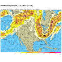
Storms will once again be a possibility tomorrow but they shouldn't be as potent or widespread. We'll have the moist, warm air in place to fuel storms but there won't be any real trigger besides a small upper-level disturbance or two that could try to form and move through. Friday night will be the best chance for storms in the near future though as a cold front sweeps through West Tennessee and North Mississippi. Since these storms will move through earlier in the evening across West Tennessee there is the possibility of a few of these going severe. The chance for severe weather decreases as you move southward into North Mississippi thanks to the later timing during Friday night that they'll be moving through. Will the rain be out of the picture in time for the Mississippi State/Auburn game on Saturday at 11am here in Starkville? It looks like that may be the case at this point but it's too far out to know for certain since the front will be exiting the region sometime during the morning. The big story instead of the storms will be the much cooler, much drier air behind the cold front. We're talking about highs in the upper 70's this weekend in West Tennessee and highs in the lower 80's across North Mississippi, both with low humidity. What a change! We just have to get through a Thursday and Friday full of the deplorable heat and humidity we've seen lately before the wonderful weekend weather arrives.
Showing posts with label dry. Show all posts
Wednesday, September 5, 2012
9/5 - 11:35pm - Stormy Week, Cooler Weekend, and TV Tomorrow!
It's been a stormy day across West Tennessee and North Mississippi as a complex of storms moved through the region this evening generating multiple instances of severe wind. The storms that caused these are still moving southeastward through Northeast Mississippi but have lost their severe punch. Even though it appears these storms will miss Starkville and the Golden Triangle in Mississippi there is the possibility that an isolated storm or two will try to form off the western end of these tonight.
Storms will once again be a possibility tomorrow but they shouldn't be as potent or widespread. We'll have the moist, warm air in place to fuel storms but there won't be any real trigger besides a small upper-level disturbance or two that could try to form and move through. Friday night will be the best chance for storms in the near future though as a cold front sweeps through West Tennessee and North Mississippi. Since these storms will move through earlier in the evening across West Tennessee there is the possibility of a few of these going severe. The chance for severe weather decreases as you move southward into North Mississippi thanks to the later timing during Friday night that they'll be moving through. Will the rain be out of the picture in time for the Mississippi State/Auburn game on Saturday at 11am here in Starkville? It looks like that may be the case at this point but it's too far out to know for certain since the front will be exiting the region sometime during the morning. The big story instead of the storms will be the much cooler, much drier air behind the cold front. We're talking about highs in the upper 70's this weekend in West Tennessee and highs in the lower 80's across North Mississippi, both with low humidity. What a change! We just have to get through a Thursday and Friday full of the deplorable heat and humidity we've seen lately before the wonderful weekend weather arrives.
Looking for something to do tomorrow night? On the Travel Channel at 10 pm/9c tomorrow night a show called Extreme Tours will be airing and the first segment of the show will feature me and my pals at Storm Chasing Adventure Tours! A crew from the show came out to film and interview us as we chased this past spring in New Mexico and their footage along with clips from my library of tornado video will be airing. This program will showcase what we do as a tour group and how we make it happen. Quite a few of our tour guests and tour guides were interviewed for this and the camera crew that came rode along with us for a few hours. I did a sit-down interview with them along with an extensive round of showing off our vehicles and equipment. This should be a good show tomorrow and I'm certainly looking forward to my first appearance on a non-news national TV program! If you can't make it home in time to watch tomorrow be sure to set your DVR.
Storms will once again be a possibility tomorrow but they shouldn't be as potent or widespread. We'll have the moist, warm air in place to fuel storms but there won't be any real trigger besides a small upper-level disturbance or two that could try to form and move through. Friday night will be the best chance for storms in the near future though as a cold front sweeps through West Tennessee and North Mississippi. Since these storms will move through earlier in the evening across West Tennessee there is the possibility of a few of these going severe. The chance for severe weather decreases as you move southward into North Mississippi thanks to the later timing during Friday night that they'll be moving through. Will the rain be out of the picture in time for the Mississippi State/Auburn game on Saturday at 11am here in Starkville? It looks like that may be the case at this point but it's too far out to know for certain since the front will be exiting the region sometime during the morning. The big story instead of the storms will be the much cooler, much drier air behind the cold front. We're talking about highs in the upper 70's this weekend in West Tennessee and highs in the lower 80's across North Mississippi, both with low humidity. What a change! We just have to get through a Thursday and Friday full of the deplorable heat and humidity we've seen lately before the wonderful weekend weather arrives.
Labels:
channel,
cool,
dry,
humid,
media,
Mississippi,
radar,
severe,
starkville,
storm chasing,
Storm Chasing Adventure Tours,
tennessee,
thunderstorm,
travel,
Travel Channel,
TV,
West Tennessee
Monday, August 27, 2012
8/27 - 9:30pm - Update on Isaac's Expected Gulf Coast Landfall
Tropical Storm Isaac is teetering on the edge of becoming a hurricane this evening with winds of 70 mph as of this writing. The threshold for a Category 1 hurricane is 74 mph. The storm motion has slowed down over the past few hours, now moving northwest at only 10 mph. Issac continues to run into issues that prevent it from rapid intensification, which is certainly good news. The latest issue is a batch of dry air that is currently being pulled into the center of the storm. Without an uninhibited source of moist air the storm cannot form a defined eye or intensify very well. The dry air is why Isaac is lopsided right now with most of the intense winds on the south side.

How long will it be until this dry air is finished working through the
storm? Probably a few more hours, possibly lasting into the early
morning hours tomorrow if current model forecasts are correct. Speaking
of models, the current track from the National Hurricane Center takes
Isaac right into the Eastern Louisiana/Mississippi Coast areas late
tomorrow night into early Wednesday morning as a weak Category 2 storm
with 100 mph winds. With the lack of organization we're seeing right now
it may only be a Category 1 at landfall. The latest computer model
tracks, the spaghetti plots as you've probably heard
about and seen over the past few days, have tightened up on a landfall
location somewhere around New Orleans. It's worth noting that some of
these models are now trending eastward after a massive amount of
successive westward jogs in recent days. It doesn't appear that this
landfall will take place further east than Biloxi, Mississippi given the
current motion of the storm and model data, but the exact landfall
location won't be the big story with this storm.
The big story here is how big and how slow this storm is. Sure, there will be some wind damage along the coast as the storm makes landfall, but the large area that Isaac covers means that quite an expansive area along the Gulf Coast will experience other effects from it. Storm surge at or above ten feet is possible in locations from New Orleans to Pascagoula, MS and rainfall amounts over a foot are forecast over much of Central and Southern Mississippi and Eastern Louisiana. Isaac will slow down even more than its current speed once it gets over land so heavy rain will be a good bet across much of the Gulf Coast states until we get into the weekend. Inland flooding will be a problem with the deluge that Isaac with unleash on the region as it crawls northward.
As far as local effects in North Mississippi and West Tennessee, Isaac will bring very heavy rain and winds with gusts in some cases near 40 mph. Starkville, MS may be looking at a six or more inch rainfall scenario through Saturday evening and areas in West Tennessee like Jackson will likely see more than three inches of rain. This highly depends on Isaac's exact track so some areas will see much more rain than others.
With just about any landfalling hurricane you can expect the threat of isolated tornadoes, and Isaac will be no different. The turning of winds with height in a hurricane or tropical storm create favorable wind shear for tornadoes to form in stronger parts of it. Due to this potential threat, the Storm Prediction Center has issued a Slight Risk for most of Mississippi and parts of Louisiana, Alabama, Georgia, and Florida.
So overall we're not looking at Isaac to be a major hurricane at landfall, but the effects from it will be widespread due to it's large size. It's a good thing that folks in a wide area are preparing for this storm since it could be a long haul given the slow motion that's expected from it.


![]() |
Storm surge exceedance probabilities |
![]() |
Rainfall through 7pm CDT Saturday |
With just about any landfalling hurricane you can expect the threat of isolated tornadoes, and Isaac will be no different. The turning of winds with height in a hurricane or tropical storm create favorable wind shear for tornadoes to form in stronger parts of it. Due to this potential threat, the Storm Prediction Center has issued a Slight Risk for most of Mississippi and parts of Louisiana, Alabama, Georgia, and Florida.
So overall we're not looking at Isaac to be a major hurricane at landfall, but the effects from it will be widespread due to it's large size. It's a good thing that folks in a wide area are preparing for this storm since it could be a long haul given the slow motion that's expected from it.
Labels:
dry,
hurricane,
Isaac,
Jackson,
Louisiana,
Mississippi,
model,
NHC,
rain,
satellite,
slight risk,
spaghetti,
spc,
starkville,
storm surge,
tennessee,
tornado,
tropical storm,
tropics,
West Tennessee
Thursday, August 23, 2012
8/23 - 5pm - Tropics, Drought, Storms... Anything Else?
![]() |
Computer model forecast tracks for Isaac |
The 5pm EDT National Hurricane Center update on Isaac has again taken a more westerly track than before thanks to the latest model data. Their forecast has Isaac remaining a tropical storm until it clears the north side of Cuba on Monday and becomes a hurricane. This all depends on where the storm tracks because the less of Cuba and Hispanola it goes over, the more time over warm water it will have. Should the storm remain weak like it is now for a longer period, a more westerly track can be expected.

How 'bout the drought? Not much has changed from last week's drought monitor product for West Tennessee and North Mississippi. Much of West Tennessee is still suffering from a severe to exceptional drought, especially in areas near the Mississippi River and Kentucky border. The area of exceptional drought, the highest level possible, has contracted a bit since last week. Areas south of Benton County and east of Bolivar aren't faring as badly as the rest of West Tennessee, but it's worth noting that rain may be hard to come by over the next week. The worst of North Mississippi's drought is still confined to areas near Tunica and areas south of West Point don't have drought conditions at this time.
Speaking of rain, we're looking at just a small chance for some isolated showers and storms on Saturday afternoon in North Mississippi as an upper-level system moves toward us from the west. This will increase our moisture and instability a touch since winds will be turning more southerly at the surface. West Tennessee will be too far north for this storm chance unfortunately. Small storm chances will be in the forecast again as we head into the early part of the workweek, but uncertainly skyrockets after that because our weather will depend on where Isaac, by then likely a hurricane, will go. A more westerly landfall along the Gulf Coast would mean quite a bit of rain for the region while a more easterly landfall in Florida wouldn't affect us too much. This again is something we'll need to watch.
Sunday, October 9, 2011
10/9 - 2pm - Can We Get Some Rain?
It's been over two weeks now since rain has been recorded in Jackson, TN, but luckily there are some rain chances in the forecast. If you look off to the east you'll see a deck of high, thin clouds that will be moving into the area later this evening. These clouds are a general outline of the westward-moving tropical moisture that will power the chance for a few showers across West Tennessee tomorrow. A more appreciable rain chance with some thunderstorms will arrive on Wednesday night as a cold front passes through. After that point we'll be left with clear skies and temperatures only in the 70's.
Check out some clips from my weathercasts on Good Morning West Tennessee and the 6pm news on WBBJ yesterday for more details on this week's weather:
Labels:
7,
ABC,
dry,
Good Morning West Tennessee,
Jackson,
media,
meteorology,
rain,
tennessee,
TV,
video,
WBBJ
Monday, October 3, 2011
10/3 - 2:30pm - Gradual Warm-Up on the Way!
After having lows in the upper 30's this morning across much of North Mississippi and the Golden Triangle, we're enjoying temperatures in the lower 70's this afternoon. High pressure will gradually move east of us this week, meaning southerly warm winds will return to the region. Warmer temperatures are on tap throughout the week here in Starkville, getting into the mid 80's by the time we cap off the workweek on Friday. The next chance of rain will be sometime early next week, so enjoy this nice stretch of weather! Check out the video below for your detailed forecast:
Labels:
cold,
cool,
dry,
media,
meteorology,
Mississippi,
Mississippi State,
TV,
video
Saturday, October 1, 2011
10/1 - 3:30pm - October Comes in Cool
Across West Tennessee this morning we saw overnight lows in the upper 40's, but luckily we've warmed up to a slightly chillier-than-average 66 degrees so far. Tonight's lows across the region will be in the mid to upper 30's. Low-lying valleys and other areas prone to cooler temperatures could see patchy frost early tomorrow morning. The rest of the week features warming temperatures and sunny skies. That's a pleasant and easy-to-digest forecast for sure! Check out the video below for some highlights from my weathercasts on this morning's edition of Good Morning West Tennessee on ABC 7:
Wednesday, September 28, 2011
9/28 - 9pm - Big Pattern Change Coming Up
A pretty sizable pattern change is shaping up for the entire Southeast that will result in some very seasonable fall weather. A large upper-level low that's been spinning over the Great Lakes for the past few days will be replaced by another trough that should dig even deeper than the current one. At the surface this will push quite a cold front through the region on Friday, which will bring in much drier air from the northwest and cooler temperatures. We're talking dew points into the 40's (60 is considered humid) over the weekend with overnight lows getting into the 40's in most locations around Mississippi and Tennessee. It will take until the middle of next week to regain some of the humidity as this trough moves east and a ridge builds in. Until then, enjoy the clear, crisp, and cool days ahead!
Be sure and tune in to Good Morning West Tennessee on WBBJ ABC 7 this Saturday at 6 and 8am for my latest West Tennessee forecast. Should be a very nice weekend!
Saturday, July 16, 2011
7/16 - 11am - Heat Building Back In
![]() |
Ridge over Central US on Wednesday |
![]() |
Thursday Eve. temperatures (GFS) |
GFSX MOS (MEX) KSDF GFSX MOS GUIDANCE 7/16/2011 0000 UTC FHR 24| 36 48| 60 72| 84 96|108 120|132 144|156 168| SAT 16| SUN 17| MON 18| TUE 19| WED 20| THU 21| FRI 22| X/N 89| 73 93| 75 95| 78 96| 79 98| 78 99| 78 97| TMP 85| 75 88| 77 90| 80 91| 81 92| 80 93| 80 91| DPT 69| 70 69| 72 70| 75 74| 75 72| 72 71| 71 70| CLD PC| PC PC| CL PC| PC PC| PC PC| PC PC| PC PC| WND 6| 6 7| 6 9| 9 9| 9 8| 7 8| 7 8| P12 24| 13 14| 7 9| 19 40| 27 20| 12 25| 14 19| P24 | 19| 9| 40| 40| 25| 34| Q12 0| 0 0| 0 0| 0 1| 0 0| 0 0| 0 | Q24 | 0| 0| 1| 1| 0| | T12 26| 8 32| 10 24| 37 49| 49 39| 29 28| 21 36| T24 | 30 | 40 | 50 | 71 | 49 | 44 |
Looks pretty hot doesn't it? A span of three or more 90 degree plus days is usually considered a heat wave, so I think we'll meet and exceed that definition easily. Next week will be a good time to take it easy and drink lots of fluids when working or playing outside. Here comes the heat!
Tuesday, October 19, 2010
10/19 - 5pm - MSU Forecast Video
We're in for a pleasant rest of the week once these showers and storms clear out of the area, although we do need the rain around here. Portions of Mississippi are in a Severe Drought according to the US Drought Monitor, but some alleviating rains could be on the way later this weekend. Check out the video below:
Labels:
drought,
dry,
meteorology,
Mississippi State,
rain,
TV,
video
Tuesday, October 5, 2010
10/5 - 5pm - MSU Forecast Video
It's been very dry around North Mississippi and it will continue to be like that for at least another week or two as high pressure stays firmly in place across the Eastern half of the US. These cool, dry, and windy conditions are creating a fire risk, so take extra caution if you're putting on a bonfire or burning brush this week. Check out the video below:
Labels:
cool,
drought,
dry,
fire,
Mississippi,
Mississippi State,
video
Tuesday, September 21, 2010
9/21 - 5pm - MSU Weather Forecast Video
It doesn't take me to tell you that it's hot out there around North Mississippi. Readings in the upper 90's were quite common across the Golden Triangle this afternoon as high pressure kept the cloud cover and precipitation away. We'll see that heat continue, but with some moderation over the next few days and a slight increase in humidity. A frontal boundary will approach the region by the weekend, so we could have a shot at some rain then. Check out the video below:
Labels:
dry,
front,
hot,
meteorology,
Mississippi,
Mississippi State,
TV,
video
Monday, August 30, 2010
8/30 - 7:45pm - Tropics Becoming Very Active / Calm in MS


Here in Mississippi we've had on and off rain over the past couple of days, but nothing all too heavy. As our air dries out from moist easterly flow from the Atlantic we've had all week, we should see a gradual decrease in clouds over the next couple days with dew points falling below 70 degrees. Our next chance of rain will happen on Friday as another cold front approaches and passes through North Mississippi. Rain chances won't be too high as the front will not have much moisture to work with as aforementioned. Don't forget to check back here tomorrow evening for my weekly MSU video weathercast!
Labels:
Danielle,
dry,
Earl,
Fiona,
front,
hurricane,
Mississippi,
Mississippi State,
NHC,
spaghetti,
tropical storm,
tropics
Thursday, August 26, 2010
8/26 - 9pm - Two Words: High Pressure
If you remember anything about the forecast over the next week, remember this: High pressure will continue to keep things sunny and dry. An area of high pressure hovering near the eastern seaboard will meander around the East and Southeast over the next week, providing us with a continuation of the wonderful weather we've had here in North Mississippi over the past few days. The humid, unpleasant air that influenced our weather last week should stay south of a stationary front over the Gulf Coast. A small surface low associated with that front could produce a small chance of showers here on Friday and Saturday night, but I don't expect anything substantial. The increased moisture that will accompany this rain chance during the weekend will also bring back a small taste of humid air to the area on Saturday, but things should dry back up by Sunday and through next week. Highs will stay in the mid 90's for the next week or so, save for Monday when we'll see a brief cool-down into the mid 80's.
It's been a slow start to the Atlantic hurricane season, but things are now in high gear. We now have Hurricane Danielle, Tropical Storm Earl, and a tropical wave off the coast of Africa that will most likely become Fiona in the coming days. Neither Danielle (which is expected to become a major hurricane) nor Earl will directly impact the United States and should stay out at sea. Earl may get within a few hundred miles of the Outer Banks of North Carolina, but I don't see it getting any closer than that given the high pressure that's expected to be in place at that point in the East US. We'll keep an eye on the disturbed weather that could become Fiona to see where that tracks, but for now the US is in the clear.
Labels:
dry,
front,
hurricane,
pressure,
stationary,
tropical storm,
tropics,
warm
Tuesday, August 24, 2010
8/24 - 5:15pm - The Return of MSU Forecast Videos!
It's a new school year and that can only mean one thing, the return of my Mississippi State University video weather forecasts! We have new graphics this year (the banner, 5-day forecast bars), and heck, I even got a new suit for the occasion! The weather won't be terribly active here in Mississippi over the next week or so, but the drop in dewpoint is certainly a welcome change! Check out the video below:
Check back next Tuesday for another video forecast!
Labels:
college,
dry,
media,
meteorology,
Mississippi,
Mississippi State,
TV,
video
Sunday, August 22, 2010
8/22 - 2:30pm - Humidity Taking a Dive / MSU Weathercasts
The heat and humidity have been relentless for the past few weeks, which is quite normal for summer here in Mississippi. While we won't be able to do anything about the heat, the humidity will at least give way somewhat over the next couple days. A cool front (you really can't call this a cold front... not one aspect of this is cold!) will drop through the Golden Triangle tonight and lower our dew points for the next week or so. These lower dew points will do two things for us: 1) Decrease the oppressive humidity in the daytime and 2) help temperatures at night drop below 70 degrees. The decrease in humidity during the hottest part of the day is a big deal because heat index values will be considerably lower than last week. Our overnight lows will dip because a decrease in air moisture (A.K.A. lower humidity) means that the air won't be able to retain heat at night and temperatures should fall into the 60's for lows. So even though we won't shake off the mid-90 temperatures with this front, the drop in humidity will do wonders for our overnight temperatures and daytime heat index values. High pressure in place across the Eastern US should keep us dry this week.
Tropical Depression Six has formed in the Atlantic and could become a hurricane by Wednesday. Winds right now are at 35mph and it's moving northwest at around 12mph. I really don't think this storm will hit the US and should curve back out to sea before it gets near to land. It's too early to say that definitively, but I think it's a good bet right now.
My Mississippi State University video forecasts return to this blog on Tuesday evening! Like last year, I'll be posting those videos every Tuesday evening as I continue to improve on my broadcasting skills. The stakes are higher this time around because I'll be putting those skills to good use in a few weeks time for something very special that will be announced soon. Like I said in the last post, this announcement will not disappoint, especially for those of you who have been following this blog for over three and a half years.
Labels:
cool,
dry,
front,
humid,
hurricane,
meteorology,
Mississippi,
Mississippi State,
tropical storm,
tropics,
TV,
video
Monday, July 12, 2010
7/12 - 9pm - So Where Did All That Rain Go? / 100 Degrees


Saturday, July 10, 2010
7/10 - 11:30am - More Rain on the Way!
After more than a week with no rain here in Louisville, Thursday and Friday really turned things around. We measured .71" of rain at my house on Thursday and Friday combined. That may be a higher number than most areas in town because we were caught under a small isolated storm on Thursday that only covered the Southeast portion of the county (see right image). Now that the cold front has passed, we're enjoying slightly cooler temperatures with lower humidity. We should get up to 90 today and a couple degrees warmer than that tomorrow.
Our next chance for rain comes on Monday as another approaching cold front fires off some showers and thunderstorms. That chance will last throughout the day on Tuesday before tapering off on Wednesday. We could get nearly two inches of rain out of this front as it comes through according to the HPC, so get those umbrellas ready!
Wednesday, July 7, 2010
7/7 - 10:30am - WAVE-TV Storm Chasing Video / Heat Continues
WAVE 3 News aired a segment last night about Kevin Harned's storm chasing trip with Storm Chasing Adventure Tours. The piece used some of my and another tour driver's tornado video to tell the story of our once-in-a-lifetime tornado intercept near Campo, Colorado on May 31st. View the news segment below:
This video is available in 720p or 1080p high definition
The heat continues here in Louisville, but a break from it is on the way. We could get very close to 100 degrees in the city today, with a repeat of that performance tomorrow. Dew points won't be extremely high, so heat index values will stay near or at 100. An approaching cold front will give us a good chance for rain on Friday, the first appreciable shot at rain in well over a week. After the passage of that front on Saturday, we'll see temperatures drop to around 90 for highs next week.
Tuesday, July 6, 2010
7/6 - 3pm - Storm Chasing Video on WAVE 3 News Tonight!
Tonight at 11pm on WAVE 3 News, meteorologist Kevin Harned will be showing a piece on his storm chasing trip with Storm Chasing Adventure Tours. You'll recall that Kevin and I saw a large, photogenic tornado in Colorado while we were out there, so you won't want to miss tonight's newscast. My video along with some from one of our other drivers on the tour will be shown during the piece. Here's an ad that WAVE has been airing over the past few days for tonight's segment:
The tropics have been hinting at some development for the past couple of days, but no organized storms have come to fruition out of the disturbed weather. One area of concern near the Yucatan Peninsula has a 30% risk for becoming an organized storm, but that's the only one for now.
Temperatures in the Northeast are extremely hot today. High pressure that has settled over the area is allowing things to really heat up. Temperatures near Philadelphia are around 100 degrees right now and numerous heat advisories and excessive heat warnings are in place.
Around here in Louisville it's still very dry! We haven't seen any rain in over a week, but an area of low pressure passing through on Friday will finally provide a good chance for some as the weekend begins. After seeing temperatures in the upper 90's tomorrow and Thursday, the front associated with the low coming through on Friday should take temperatures down to around 90 for the weekend. Stay cool!
The tropics have been hinting at some development for the past couple of days, but no organized storms have come to fruition out of the disturbed weather. One area of concern near the Yucatan Peninsula has a 30% risk for becoming an organized storm, but that's the only one for now.

Around here in Louisville it's still very dry! We haven't seen any rain in over a week, but an area of low pressure passing through on Friday will finally provide a good chance for some as the weekend begins. After seeing temperatures in the upper 90's tomorrow and Thursday, the front associated with the low coming through on Friday should take temperatures down to around 90 for the weekend. Stay cool!
Thursday, July 1, 2010
7/1 - 5pm - Hurricane Alex Landfall / Where's the Humidity?

[Yahoo! News / KRGV-TV]
Aside from a hurricane, the other weather story of note is the lack of humidity around the Ohio Valley. In Louisville right now, the dew point is a very comfortable 49 degrees with a temperature at 82. Remember that we had dew points in the upper 60's and 70's last week, which is oppressively humid. When will the typical July heat and humidity return? It looks like July 4th is when we'll see temperatures in the 90's again with rising dew points as an area of high pressure moves to the east of us (see image on right), which will allow humid air from areas near the Gulf of Mexico to surge northward. We won't see any rain here this week as high pressure remains the dominant factor in our weather. It's pretty dry around here, so we definitely need a good soaking. A cold front will attempt to make its way through the area this time next week, so I'd say that would be our next chance of rain in Louisville.
Subscribe to:
Posts (Atom)