Showing posts with label Nebraska. Show all posts

Friday, June 29, 2012

6/29 - 10:15am CDT - The Chase Ends...

Today we're heading back to Denver as Tour 8 with Storm Chasing Adventure Tours ends. Right now we're making the seven hour journey from Valentine, Nebraska where we stayed last night. We had a storm about an hour south of Valentine yesterday that showed some promise, but it fell apart as it moved east. Tomorrow is when everyone departs and that's my cue to get on my plane back home to Louisville. It's been a great week with just about every day being a day with an active chase.

This is not one of those chase days unfortunately. With our required drive back to Denver we don't have time to chase any storms that are more than a few miles away from our route. There is a Slight Risk for storms today in Northeastern Nebraska stretching into South Dakota, but that's just too far out of the way for us. We may have a few run-of-the-mill storms along our route back to Colorado, but that's about it. I'll have a post tomorrow detailing our mileage and route from this week.

Thursday, June 28, 2012

6/28 - 11:30am MDT - Waking Up in Nebraska

After storms in Northeast Colorado yesterday became contaminated by storms coming off the Front Range, we decided to head east to be ready for today's chase. After waking up in Ogallala, Nebraska this morning we're rested up for a relatively leisurely day without too much driving since we're already pretty much in our target area for the day. The Storm Prediction Center has a general thunderstorm risk out for Western Nebraska, Northeast Colorado, and Northwest Kansas today with a 5% severe wind risk.

The focus today will be a cold front that's slowly moving through the region today. Winds around this frontal boundary may shift out of the east a little bit and that's where we'll position ourselves since the best shear will be where that happens. Dew points will be in the 60's across Central Nebraska this afternoon with slightly lower readings to the west. These surface winds, while weak, and the moisture should be more than enough to get some storms going.

Winds aloft are a little less certain since they may change throughout the day. Early on this morning winds at 500 mb (18,000 feet) were almost westerly across the western half of Nebraska, but already we've seen a shift to the southwest. While not terribly strong, the winds up there could have just enough punch to get storms to become severe. Small embedded shortwaves within the flow may enhance these winds a bit in some areas too. By 6pm MDT tonight the RAP model (right) still has these winds out of the southwest aloft, so that's some good news. The thinking at this point is that the shear won't be high enough to keep storms from merging together and being clustered, but we'll see how that plays out.

Follow me on Twitter and Facebook for constant updates during our chase!

Monday, June 25, 2012

6/25 - 10:30am MDT - Great Faces. Great Places.

Today's blog post title is the South Dakota's state slogan. As you can probably gather by that, we're in South Dakota today! Southwesterly flow aloft at 500 mb (18,000 feet) will be present in the western half of South Dakota, northwest Nebraska, and Eastern Wyoming today as the general pattern we dealt with yesterday continues. While the winds aren't terribly strong, the RAP model is beginning to pick up on an area of enhanced speeds near 30-40 knots around parts of Western South Dakota and Northwestern Nebraska. If this enhanced area verifies there could be some better storms under it.

At the surface right now there are southeasterly winds across this area, but the more easterly of the wind vectors are favoring Western South Dakota right now. We'll see how this develops throughout the day as surface conditions continue to change. We'll want these more easterly wind vectors becuase they'll contribute to low-level wind shear that could possibly lead to rotating storms, should they form.

I say "should they form" because we're still dealing with some very warm temperatures aloft. These warm temperatures aloft, called "the cap", inhibit storm development because rising air parcels can't continue to rise buoyantly if the environmental air around them is warmer than they are. The good news here is that temperatures at the surface today will again be in the 90's to near or above 100 degrees. This will really heat up these surface air parcels so that they might shoot through the cap. All models I've looked at this morning have the cap breaking at some point in the early to mid afternoon, but where exactly this happens is still in question. The 14z RAP model has an interesting hole in the cap at around 4pm near Rapid City, but our current thinking is that the Black Hills near Rapid City will be a focus for storm development because they are a constant source of lift and thus a typical location for storm initiation.

To get some of the heating we'll need for storms to form today, we need to have a plentiful supply of sunshine. Right now we do have a layer of clouds over South Dakota that is inhibiting this right now, but western parts of the state are clearing out and it should hopefully leave us with blue skies later this morning. Storms should form sometime after 3pm this afternoon should things come together as forecast. The main threats will be wind and hail from any storm that forms, but we'll be on the lookout for some rotation in these storms as well. The Storm Prediction Center has a general thunderstorm risk for our target area today, but also mentions a 5% severe wind and hail risk.

Follow me on Twitter and Facebook for the latest updates this afternoon!

6/24 - 11:55pm MDT - An Unexpectedly Great Chase Today!

I can't say that I fully expected to see a great storm today. With all the intense surface heating and warm air aloft coupled with weak upper-level winds, the odds were against us. The great thing is that a storm did indeed form in this environment and it took advantage of every ounce of energy it was given from what it looked like. This storm split into a couple parts at one point and these parts were battling each other out for a while before merging back into one mean storm. This storm did have a few radar scans of rotation and we could certainly see it from the ground for a few minutes as a brief rotating wall cloud formed. A fleeting finger-like funnel danged down for a moment at the peak of the rotation, but it was gone by the time we all pointed it out and raised our cameras to capture it. Something that stuck in the back of my mind is what I posted on the Storm Chasing Adventure Tours Facebook page last night in an update:
Looks like we may be heading north from Denver in the morning! A few storms may try to develop during the afternoon and evening tomorrow where South Dakota, Nebraska, and Wyoming meet.
The intersection of South Dakota, Nebraska, and Wyoming is almost exactly where this storm formed today. Where the three white lines intersect to form a rotated "T" on the upper-right of the radar image to the left is where these state lines come together. My estimate of where we would end up was an educated guess based on data, but I really didn't expect it to come so incredibly close. The other thing about this storm is that it was the only severe storm west of the Mississippi River at the time we were chasing it during the late afternoon. Storms that developed to the south of us in Northeast Colorado just couldn't get strong because it was much too warm both at the surface and aloft.

Check out the video below to see the storm in action and then check out my Flickr or Facebook storm chasing albums for even more views of today's chase:


Tomorrow we'll be heading northward to the Dakotas or Wyoming. The Storm Prediction Center has a 5% risk for severe weather, but we'll be looking at all the data tomorrow morning to see how it all shapes up! Be sure to check back around noon tomorrow on the East Coast for a complete blog update with a discussion on where we're headed.

Sunday, June 24, 2012

6/24 - 10:35am MDT - The Chase Begins!

This morning we're heading toward Cheyenne, Wyoming from Denver as we continue to look at weather data coming in. Today's setup still looks marginal by most accounts, but there are a few small features that could cause a few isolated storms to go severe. For one, surface winds out of the east in Wyoming, Northeast Colorado, and Nebraska will generate upslope flow, which is the lift mechanism we need to get storms going.

These winds will also create some shear because they will be interacting with southwesterly winds at 500 mb (18,000 feet). The issue with this is that the faster winds at this level will be further north toward Rapid City, South Dakota instead of where the more favorable surface winds will be just to the south. In any case, the wind direction at 500 mb will be good enough to usher in the wind shear and maybe some drying of the air at that level to increase instability.

When you put the expected helicity (caused by wind shear) and the instability together for today, you get the Energy Helicity Index (EHI). According to the 14z RAP model, the EHI may try to ramp up a little bit in Northeast Colorado and it even breaks out a little bit of precipitation just west of there too. Surface heating is going to be massive since temperatures will be in the 90's and 100's in some places, so we're hoping this also helps overcome some of the warm temperatures aloft (the cap) so that isolated storms can develop. We're grasping for small features today since there isn't any one thing jumping out to get our attention, but so far it looks like a storm or two could fire on the elevation near Cheyenne. We'll also be watching an area closer to Rapid City, SD to see how things develop up that way.

Follow my continuous chase updates on my Twitter and Facebook accounts today!

6/23 - 11:30pm MDT - Who's Ready to Go North?

Our tour guests have been through orientation and now we're ready to set off for our northward journey tomorrow from Denver to the region where Wyoming, Nebraska, and South Dakota meet. This area will be on the northwestern side of the large ridge in the middle of the country and on the eastern side of the trough coming onshore from the Pacific. This means there will be southwesterly winds aloft, at 500 mb or 18,000 feet, to hopefully bring in some drier air so that instability will increase when it contrasts with the warm, moist air at the surface that will be rising into it. While weak in speed, the winds up there will also increase wind shear because they will be at odds with the easterly and southeasterly winds at the surface. This will increase helicity a little bit, which is a corkscrew-like rotation in the atmosphere that is good for fueling rotating thunderstorms.

Moisture shouldn't be too big of a deal since dewpoints will be in the 60's, but we'll be eying the potential for issues with the the cap, which is a warm layer of air above the surface that inhibits thunderstorm development. All the warm air in place over the central part of the country breeds strong capping since the warm air is in place at the mid levels, but the models are suggesting that this cap may be overcome tomorrow afternoon and lead to some isolated storms. At this point there is nothing that suggests any storm that forms will be anything past marginally severe, but the helicity that the NAM model is picking up on above is certainly worth keeping an eye on.

The Storm Prediction Center has a general thunderstorm risk out for our target area tomorrow with no chance for severe weather. Since storms will be pretty isolated and in a fairly unpopulated area, it may not be worth it for them to issue any sort of severe risk with a setup this marginal. We'll see how things have developed overnight when we set out in the morning though. A secondary low may try to form in western South Dakota tomorrow according to the NAM and that may influence our decision on where to go if it forms since the best winds will be just to the north of the low center. Hopefully we'll see some storms!

Follow me on Twitter and Facebook for the latest tomorrow!

Thursday, May 24, 2012

5/24 - 12:35am CDT - We're in... Iowa?

We didn't think we'd be in Iowa tonight. The storms that formed yesterday (Wednesday) rushed eastward as the cold front in the region decided to push further east than expected. Unfortunately none of these storms really did much because they formed in a linear fashion and didn't have the moisture necessary to get too severe. One of the southern cells in the line just west of Omaha, Nebraska managed to be isolated for a while and generated a wall cloud that triggered a tornado warning. Our only option in this environment was to cross the Missouri River in Omaha and wait for the storms to come to us because it would not be good to have the storms outrun us while trying to find a way across the river. The storms slowed down and died out pretty much at that point so we threw in the towel for the day.

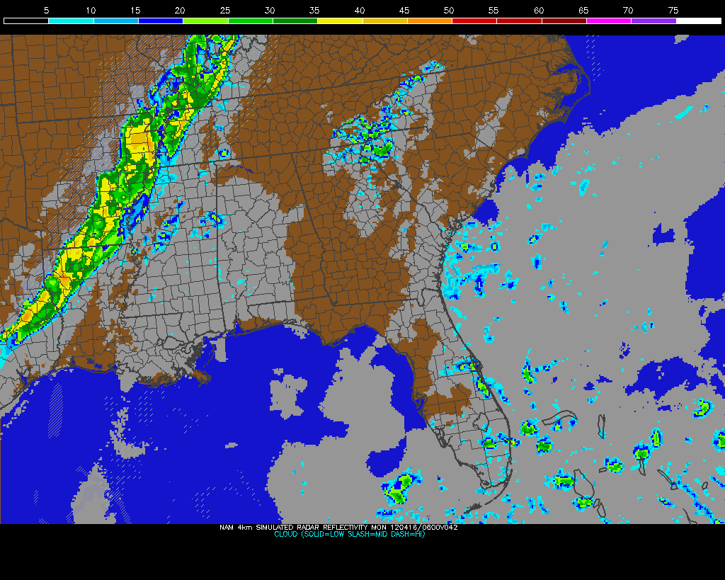
Tomorrow will likely be a travel day back to Kansas or Southern Nebraska as we await Friday's potential chase setup. Storms tomorrow will be up near the Great Lakes in Wisconsin and Michigan and we just don't chase there due to the distance from the Plains and lack of good chase environment up there. Strong capping should keep storms from going up in the central and southern Plains, but we'll keep an eye on that in case that changes. Friday's setup may be decent if capping aloft doesn't ruin it. A deepening trough out in California and hopefully some better moisture return from the Gulf of Mexico should create potential for severe weather. A strengthening low in Southeast Colorado/Southwest Kansas should provide ample surface wind support for rotating storms should this pan out as forecast. The Storm Prediction Center already has a 5% risk area for this in their 3-day severe weather outlook. I'm crossing my fingers that this setup will yield some good storms because Friday is my last day chasing in the Plains until late June!

Follow me on Twitter and Facebook for updates this week.

Tuesday, May 22, 2012

5/22 - 9:45am MDT - Nebraska Here We Come!

Today's storm setup is tricky because we're dealing with, again, a situation where the moisture is not returning to the region as well as we need it to. The good news though is that the trough that is slowly making it's way eastward will finally be in play today, so upper-level wind support will be there for storms. Let's start with the moisture though. The higher dew points will be in the Dakotas today no doubt, but this is at the surface. With such a short time between being dry and having moisture moving into that region, this moist layer is likely very shallow and confined near the surface even though the short-range models this morning show it a little deeper than before (models have not been handling moisture well at all lately). This means that storms up that way would likely be low-precipitation supercells, maybe to the point where some of them are only putting down virga and not ground-falling rain. The better surface wind support near the low will also be in the Dakotas, but you won't get many, if any, tornadoes if the storms can't get any "meat" on them from the lack of moisture. Dew points in Northern Nebraska may be lower at surface, but we may have an overall deeper layer of moisture there.

The upper-level winds as I said before will be more favorable today than yesterday. The trough moving in will provide fast southwesterly winds in the Dakotas extending down to Northern Nebraska. This should bring in some drier air aloft and enhance wind shear for this afternoon's storms. Today we'll stay on the southern end of these winds aloft so that maybe we can get some deeper moisture coupled with the winds. Hopefully some supercell storms can form in this environment.

Because the models are having difficulties resolving moisture issues, today's CAPE (instability) forecast looks rather low in Nebraska with higher values north. This is something we'll be watching throughout the afternoon to see where it actually sets up. The potential lack of moisture and the best shear being removed from deep layer moisture will likely limit tornado potential today, but maybe we can see some high-based photogenic storms!

The Storm Prediction Center has a Slight Risk for severe storms today in the Dakotas extending toward Northern Nebraska. There's only a 2% tornado risk with this and I think this is a good call given the moisture issues here. If dew points were to be higher over a deeper layer in North Dakota I think you could have a pretty decent tornado risk from supercells given the forecast wind environment. In any case, our more southerly target today will put us in great position for tomorrow's chase, which will likely be in Nebraska.

Follow me on Twitter and Facebook for updates today!

5/21 - 11:55pm MDT - Nice LP Supercell Today

Today didn't turn out to be the best chase, but we made the best of it with the sighting of a nice low-precipitation (LP) supercell near Grande, New Mexico. This formed within a line of discrete storm cells that stretched from Southeast Colorado to Central New Mexico. The formation of these cells in a line among an environment characterized by northwest wind flow at 18,000 feet (500 mb) didn't make for the best conditions for severe storms, but a few of them did reach severe limits. Besides this low-profile supercell and possibly a couple others in the same line, an "out of the blue" classic supercell formed ahead of an eastward-advancing MCS (mesoscale convective system - line of storms) just west of Amarillo before being ingested by the actual MCS. It didn't form in the expected environment for this, so we were not in position to see this short-lived storm. More photos of the LP supercell we saw today are available on my Flickr and Facebook albums.

Our tentative plan for tomorrow is to head to the Valentine, Nebraska area to intercept a severe weather threat that may manifest up there as a large-scale trough begins affecting the Northern Plains. Many would consider this an "secondary" target area since higher dew points and better surface winds will be in North Dakota, but in this case the moisture up in North Dakota will likely be confined to an area closer to the surface since there will not be enough time for ample deep moisture to make it up that far north. Northern Nebraska should have some deeper moisture than North Dakota and even though less helicity (spinning motion in atmosphere) will be present in Nebraska, Energy Helicity Index values are still forecast to be elevated according to the Rapid Refresh model. We'll make a final determination based on data coming in tomorrow morning before heading out!

Follow me on Twitter and Facebook for updates on our chase!

Saturday, April 14, 2012

4/14 - 2:30pm - Nice West TN Weekend, Outbreak in the Plains

Sunday Night storms on NAM Model
It's a nice weekend across West Tennessee with warmer temperatures and breezy conditions. Another day of 80-degree weather is on the way for Sunday, but storms will roll through the region on Sunday night into Monday morning. Some of these storms could be a little strong, but they shouldn't be terribly severe, if at all, since they will be weakening as they approach the Mississippi River. Rain chances should subside completely after Tuesday and sunshine with highs in the 70's will be with us through the middle portion of the workweek. Check out my video from this morning below for more details!


A potent severe weather outbreak is just getting started in the Plains right now. Areas from Nebraska to Oklahoma are under a rare High Risk of severe weather from the Storm Prediction Center and violent tornadoes are expected this afternoon and evening. Already we've had quite a few reports of tornadoes touching down and doing damage in Kansas this afternoon, and more of the same can be expected as this system pulls more moisture northward and destabilization continues. On the left you'll see the latest EHI chart from the SPC, which is a measure of helicity (spinning motion in the atmosphere) and instability. This is a decent indicator of where the strongest tornadoes could form. It's really ramping up with values as high as 7 in Oklahoma right now, but those values are expected to increase and possibly move northward this afternoon and evening into Kansas and Nebraska.

Be sure and join me again on WBBJ for 7 Eyewitness News at 6 and 10pm tonight!

Thursday, June 2, 2011

6/2 - 10:45am CDT - South Dakota Today, Not Looking Very Promising

We saw a small supercell last night near Valentine, Nebraska with a very picturesque sunset behind it. Since there were no road networks in the area we had to stay a good distance away from it and unfortunately it didn't last long either. If it had developed a couple hours earlier it would've been a big storm!


I'm no fan of today's severe weather setup in South Dakota. The main thing this morning that throws up red flags is the cirrus cloud shield over much of the state. This isn't something that burns off during afternoon heating, but is rather persistent. This shield will act to limit instability this afternoon and could keep storms from firing until after dark or not at all. Dew points at the surface are a bit marginal this morning and it's not a sure thing that they'll recover this afternoon because of computer model issues lately. We won't get a true east wind for good low-level wind shear either, so that's another thing to throw in the bin of issues.


Nevertheless, we're going to drive up to south-central South Dakota (short drive) and wait there to see how things develop. Maybe Mother Nature will surprise us. The Storm Prediction Center has a Slight Risk area out for much of South Dakota, but that may be in jeopardy right now based on current conditions.


Wednesday, June 1, 2011

6/1 - 10am CDT - Moving South Today

We're ready for storms today after a long drive back south from Detroit Lakes, MN yesterday. We started the day in Oacoma, SD and are headed westward to catch a southern route near Murdo, SD. We expect to keep heading south through Nebraska until we see a good spot where winds and cloud formation become conducive for supercell development. That area could be as far south as Goodland, Kansas. West-southwest flow at 500 mb and moisture surging northward will create the instability needed for this afternoon, while east-southeast winds will contribute to the low-level shear necessary for rotating storms. The one issue we're dealing with this morning is cloud cover across much of Nebraska and portions of Kansas. It should burn off/move out in time for storm development, but if it doesn't we may have an "event failure" (AKA no storms). Check out the satellite image below and you'll see what I mean:


The Storm Prediction Center has issued a Slight Risk for severe weather this afternoon and tacked on a 5% tornado risk as well.


As we keep an eye to the sky this afternoon I'll be posting frequent updates on Twitter and Facebook. Be sure to follow me on those sites for the latest reports!

Tuesday, May 31, 2011

5/31 - 12pm CDT - Minnesota? / Back to Nebraska

We're departing Detroit Lakes, Minnesota for Nebraska this morning. Many of you are probably asking how on earth we ended up in Minnesota last night. Here's the deal: The area of low pressure that we tried to stay up yesterday with kept moving northward and we had to follow it into the Fargo, North Dakota area. The cap (warm layer of inhibiting air) was broken with 4500 J/kg CAPE (!) for nearly four hours yesterday, but the low kept moving around. This meant that the east wind component needed for supercell formation wasn't staying in the same place either, so elements just weren't lining up in one spot for a long enough time to get anything going. Once we finally threw in the towel, we headed just a few miles east to Detroit Lakes, Minnesota for a nice evening in the town with a view of the lake.


Not all was lost though, because we did have a fast-moving squall line of storms move through Detroit Lakes while we were eating dinner. We had heavy rain and lightning where we were, but just a few miles west in Fargo, ND they sustained some wind damage due to a bowing segment in the line of storms.


Westerly flow aloft and southeasterly winds at the surface will return to Nebraska/South Dakota tomorrow as an area of low pressure moves into Colorado. These winds at the surface should usher in dew points that will break 65 degrees, so moisture should not be a problem as it returns to the Plains. Instability also looks good and it appears the cap will break tomorrow in the later afternoon hours. With all of this put into play, the Storm Prediction Center has issued a 15% Slight Risk area for severe weather in Nebraska, parts of South Dakota, Minnesota, and Iowa. They even have a hatched area for an enhanced risk and their discussion calls for supercells with a few tornadoes possible. Looks like the chase is on again tomorrow!


Monday, May 30, 2011

5/30 - 10:15am CDT - Time for Some Northern Plains Action

We're off to Eastern South Dakota (Northeast Nebraska maybe?) to intercept storms that will form up that way. This has so far been a difficult forecasting day because the computer forecast models show an area of low pressure in Nebraska this morning, but each have a slightly different scenario on where it ends up. Some are even forming a secondary low to the north this afternoon. The general rule for today is to drive to where the east winds are and adjust our position as necessary because we simply can't trust any model output. This is one of those days where skill in analyzing surface conditions and cloud formation will be key.


Since moisture, instability, and shear will all be ample today combined with the east winds, wherever they set up, the Storm Prediction Center has issued a Moderate Risk for severe weather with a 10% tornado risk. Supercells that form today won't stay isolated for very long since directional shear will be parallel to the cold front pushing through according to the SPC. If this happens as forecast, we may only have a short window to chase a good storm with a tornado risk, so being on-time is very important. That's why we left North Platte, NE at 8am his morning. We should be in our target area early this afternoon.


As we pulled in a restaurant to eat breakfast this morning, we saw The Weather Channel's Tornado Hunt vehicles in the parking lot. We also saw quite a few other chasers pull in to restaurants and hotels in North Platte last night, so I'm sure that town was happy to see the quick uptick in business generated by all the chasers.


Be sure to follow me on Twitter and Facebook today. I'll be posting frequent updates and photos from our chase, which should be a good one if the forecast plays out.

5/30 - 12am CDT - Upslope Storms Part Deux Fell Flat

Our second attempt in chasing upslope storms within a week fell flat today. Like last time, the cap stayed on too tight and a layer of clouds and fog overspread our target area just as we thought storms would initiate. While we waited this afternoon just east of Cheyenne, WY, we ran into Mike Bettes and the Weather Channel's Great Tornado Hunt crew.

The very fog that moved into our target area only grew thicker as we moved into Nebraska to try and limit our driving time needed for tomorrow. At it's thickest point, the fog dropped visibility to around 300 feet as we headed east on I-80. We literally could not see the signs on the side of the road until they were just to the right of the edge of our hood.

Tomorrow could be a pretty big day in the Dakotas and Northern Nebraska. The Storm Prediction Center has issued a Moderate Risk (45%) for portions of the area and expects a few significant tornadoes tomorrow afternoon before the storms merge into a linear line. I'll have an update tomorrow morning when we get on the road, which will be early so that we can get to our target on time.

Friday, May 27, 2011

5/27 - 10am MDT - Denver, Amarillo, Denver

The next 36 hours are going to be a whirlwind. We stayed in Denver last night after trying to chase an upslope storm setup in Eastern Colorado that didn't materialize thanks to cloud cover and possibly marginal southeast winds. We're now on our way to Amarillo to drop off our tour guests from tour 4 so they can leave on their flights tomorrow morning. We'll be leaving too... back to Denver again so that we can receive our new guests on tour 5 and begin another week of storm chasing. So, 8 hours to Amarillo today and 8 hours back to Denver tomorrow. We drove 414 miles yesterday in search of severe weather, and it's a shame that it didn't work out.


Next week's weather looks promising for chasing. Sunday will most likely be a day to setup for Monday's chase in the Eastern North Plains, but there's a chance something could fire in Nebraska while we're on our way. Monday already has a risk area outlined by the SPC in Nebraska, South Dakota, Iowa, Minnesota, and North Dakota. Tuesday will probably be a down day as a bit of a trough builds in. The rest of the week will most likely be a chase in the North Plains as well, but it's a bit too far away to make an accurate guess at where exactly we'll be. Looks like we may be lacking upper-level support in many areas after Tuesday, but we'll see how things shape up.


Monday, May 9, 2011

5/9 - 10:30am CDT - On the Road to Valentine

We're on the road to our initial target location today, Valentine, Nebraska. Easterly winds caused by an area of low pressure centered just west and slightly south of this area are the focus of why we're heading there today.


Temperatures at 700mb are between 11 and 12C over a good chunk of Southern SD/Northern NE, so at least we'll have that on our side for tornado development. Moisture is still a bit short in the area, but some of the very latest short-range models indicate dew points reaching 65 and higher west of Sioux Falls, SD, which would be a very welcome development. Again, with a lack of upper-level windspeed the threat for tornadic supercells is iffy, but at least a couple of variables like surface winds and 700mb temperatures are in our favor. I'll be updating on Twitter and Facebook throughout the day!

5/9 - 8:30am - South Dakota Today... Maybe We'll See a Storm?

The overnight computer model runs have toned down the severe weather threat in South Dakota for this afternoon. While east winds at the surface and instability should be OK, the upper-level wind support that we need for supercells to form will be entering the region after the peak time for storm development. This is a problem because it limits our wind shear, much like yesterday. Moisture is another issue because dewpoints (green numbers on plots in left image) in South Dakota this morning are still in the 50's. Models are in disagreement as to whether they will actually recover into the mid 60's, but based on the performance we saw yesterday I'm inclined to think the models with lower dewpoints will be the more correct ones at the end of the day. With these issues, the SPC has issued a Slight Risk of severe storms for the western part of the state, but the 2% tornado risk runs through the eastern portion of the state as well:


Our target area will most likely be somewhere in the eastern two-thirds of the state south of Fort Pierre. We'll see what happens as we're driving along... I think we will see storms today but there's not a lot of evidence to support a good tornado risk. That's too bad after seeing the good potential for today on yesterday's model runs. Things always change, so surprises could be in store.

Be sure to follow me on Facebook and Twitter for the latest storm chasing photos and updates!