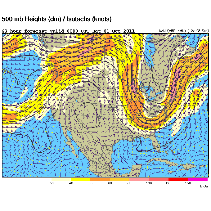
A pretty sizable pattern change is shaping up for the entire Southeast that will result in some very seasonable fall weather. A large upper-level low that's been spinning over the Great Lakes for the past few days will be replaced by another trough that should dig even deeper than the current one. At the surface this will push quite a cold front through the region on Friday, which will bring in much drier air from the northwest and cooler temperatures. We're talking dew points into the 40's (60 is considered humid) over the weekend with overnight lows getting into the 40's in most locations around Mississippi and Tennessee. It will take until the middle of next week to regain some of the humidity as this trough moves east and a ridge builds in. Until then, enjoy the clear, crisp, and cool days ahead!
Be sure and tune in to Good Morning West Tennessee on WBBJ ABC 7 this Saturday at 6 and 8am for my latest West Tennessee forecast. Should be a very nice weekend!


No comments:
Post a Comment