Monday, June 28, 2010

6/28 - 11:30am - Tropical Storm Alex Could Hit TX as a Hurricane

Overnight model runs and analysis have taken the track of Tropical Storm Alex further north than before, meaning areas near Brownsville and Corpus Christi, Texas are in the cone of potential for the storm to make landfall as a hurricane early Thursday. The spaghetti chart, which is a composite of computer forecast tracks, has made a very noticeable northward shift since 24 hours ago and the National Hurricane Center's track has shifted with it. Water temperatures in the area near landfall are in the mid to upper 80's, meaning Alex can sustain its strength as it nears shore. Right now the storm appears fairly disorganized due to its travels over the Yucatan Peninsula yesterday, but the storm is definitely rotating and strengthening. This storm could become a category 2 hurricane before it hits land, which is not considered a major hurricane but can still inflict quite a bit of damage. A Hurricane Watch has already been issued for the Texas coastline:

A HURRICANE WATCH IS IN EFFECT FOR...
* THE COAST OF TEXAS SOUTH OF BAFFIN BAY TO THE MOUTH OF THE RIO GRANDE
* THE COAST OF MEXICO FROM THE MOUTH OF THE RIO GRANDE TO LA CRUZ

It's not too often that you see the first Atlantic storm of the year become a US-landfalling hurricane, so it will be interesting to see how this develops.

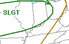
Around here in Louisville, we're experiencing cooler temperatures this morning after a line of storms came through the area last night. There's a chance for some scattered storms this afternoon, but high pressure should set in for the rest of the week and provide sunny skies with temperatures in the 80's. Sounds better than mid 90's with heat index values in the 100's, doesn't it?

Friday, June 25, 2010

6/26 - 12am - Tropical Depression ONE

The first tropical depression of the season has formed in the Atlantic, meaning we could very soon have our first named storm of the year, Alex. Tropical Depression ONE is slated to hit the Yucatan Peninsula tomorrow night before tracking northward. There's some debate over whether the storm will take a westward or eastward turn after getting north of the Yucatan, but current models are favoring the westward solution that takes it into Mexico instead of the Gulf Coast. We'll see how this track develops over the next 48 hours, but right now it looks like the United States will miss the brunt of the storm. Let's hope it stays that way! To the left is the current forecast track from the National Hurricane Center and to the right is a compilation of computer model forecast tracks called a "spaghetti" chart.

It's been a hot start to the summer across Kentuckiana, but it appears there will be a break from the heat as a cold front passes through the region on Monday. Not only will we see rain chances around Louisville on Sunday and Monday, but we'll also see temperatures drop into the 80's for the rest of the week. Until then, temperatures in the mid 90's and heat index values above 100 will persist.

Don't forget to watch my 2010 storm chasing documentary in the blog post below. You can also watch a shorter version of it on YouTube.

Thursday, June 24, 2010

6/24 - 8:30am - Storm Chasing Documentary, 1000th Post!

This is my 1000th post on the blog, which I started back in January 2007. It's hard to believe that three years have passed already, but I will continue to post here rain or shine!

I just finished putting together my fifteen minute storm chasing documentary for this year, which includes my best video from my four weeks of chasing in the Plains. It's available in high definition, just click on the "HD is off" button to see it in 720p HD format (you will be redirected to the video on Vimeo's website).


This video will be posted on Facebook soon, along with a shorter version (due to a time limit) on YouTube.

Sunday, June 20, 2010

6/20 - 5:30pm - Summer Starts Tomorrow, but it's Already HOT!

After a nice week on the Gulf Coast in Florida, I'm back home in Louisville. There were no sightings of tar balls or oil between Destin and Panama City while I was there, but both were creeping closer to shore according to reports. That area is just too beautiful to be spoiled by such an environmental catastrophe. Let's hope the spill doesn't go as far as forecast and that the right solutions are found to clean up the mess that many in Alabama, Mississippi, and Louisiana are already dealing with.

It's 91 in Southeast Louisville right now, but when you add on the 72 degree dew point, it feels like 100 out there. A Heat Advisory is in effect until 6pm this evening, but I'm sure we'll see quite a few of those issued this week. Our average high temperature in Louisville for this time of year is 84 degrees, so we are definitely quite a bit above average. With high pressure and southerly winds in place, that heat will stick around for quite a while. I'd like to point out that summer starts tomorrow and we've already had quite a few days in the 90's already. Looks like we could be in for a scorcher of a summer!

Severe weather is cranking up across Kansas right now and Nebraska is in line for some later this evening. Parameters like instability, surface winds, and EHI are looking ripe for supercells with tornadoes possible. The SPC has issued a 10% risk for tornadoes and a Moderate Risk for severe weather across the Northern Plains, so the storm reports could be quite interesting as they come in this evening.

Thursday, June 17, 2010

6/17 - 1pm CDT - Parasailing Video from Yesterday

I went parasailing on Panama City Beach, FL yesterday for the first time ever. It was great to see the beach from 300 feet in the air! A few thunderstorms formed just a few miles from the beachfront, but they stayed far enough away from us. Here's some video:


There still is no oil on the shores between Destin and Panama City Beach, but we've heard word-of-mouth reports this morning that an oil sheen was spotted a half-mile off a pier in Sandestin, FL.

Tuesday, June 15, 2010

6/15 - 10am CDT - Hello from the Florida Gulf Coast!

After four fun days of camping in the Tennessee heat at the Bonnaroo Music Festival, I'm glad to report that I've made it to Grayton Beach, Florida! I'll be here all this week on vacation and it'll for sure be a great time.

So far no tar balls or oil has come ashore in this area, which is sandwiched between Panama City and Destin, Florida. The computer forecast models for this oil spill are bringing some oil pretty close to shore this week, but hopefully it will be far enough away for the beaches to stay open.

Wednesday, June 9, 2010

6/9 - 10:30am - Leaving for Bonnaroo Tomorrow!

I'm off to the Bonnaroo Music & Arts Festival in Manchester, Tennessee tomorrow. This will be my third time at the festival, which this year features musicians and groups like the Dave Matthews Band, Norah Jones, Stevie Wonder, and former Tonight Show host Conan O'Brien. While there are some hotels and other accommodations available in and around the festival, most people (including us) opt to camp out. This isn't your typical camping trip because attendees like to construct elaborate campsites with solar-powered L.E.D. lights, flags, speakers, and more. Should be fun! I won't have reliable internet access from the festival, so I won't be able to post on the blog until next week. Here's a weather forecast from the NWS if you're going:


Once Bonnaroo is finished on Monday, I'll be making my way down to Grayton Beach, Florida for a week of vacation. Reports of a few tar balls washing ashore from the Gulf oil disaster in this area have been coming in over the past few days (I'll post pictures here if I find any), but we'll see if the beaches remain open. The Florida Gulf Coast is a great place to vacation even if the beaches are closed, so it should be a great week anyway!

Tuesday, June 8, 2010

6/8 - 2:30pm - Storms Coming to Louisville

A MCS (mesoscale convective system - a line of storms) is headed for Louisville this evening from Illinois. There are no severe weather warnings associated with this line of storms, but I think heavy rain will be the biggest issue as it comes through after midnight. The Storm Prediction Center has placed areas just north and west of Louisville under a Slight Risk for severe weather today in light of the MCS making its way through.

More storms are possible tomorrow afternoon as a cold front nears the Ohio River. We're under another Slight Risk for severe storms tomorrow, but my thinking is that Southern Kentucky will be under the greatest threat as instability increases tomorrow ahead of the southeastward advancing cold front. Heavy rain will again be the biggest risk around here tomorrow as precipitable water numbers will be quite high across the region. We could easily end up with nearly an inch of rain or more by Friday here in Louisville according to the HPC's QPF outlook. Extreme amounts of four inches or more are possible south of St. Louis.

Monday, June 7, 2010

6/7 - 11:15am - New Storm Chasing Highlights Page

I just posted a page on my website with all my best video and photos from this year's storm chase. You can access this page from the front of RyanHoke.com or follow this link: http://ryanweather.org/stormchasing2010.html. Also, my tornado video from last Monday near Campo, Colorado has been posted on the TornadoVideos.net YouTube account. Should be interesting to see how many views it receives!

An EF3-rated tornado near Millbury, Ohio killed seven people and damaged numerous homes and businesses on Saturday (read more). We were fortunate that none of the tornadoes we saw over the past few weeks damaged any homes or caused injuries, so it's very difficult to hear about a tornado that did. This underscores the importance of having access to severe weather warnings via NOAA Weather Radio or an electronic notification service, especially because tornadoes can strike at night when you're unprepared. Experiencing tornadoes out in open fields while storm chasing is one thing, but having a tornado hit your hometown is completely different. Stay safe this season!

Saturday, June 5, 2010

6/5 - 11:30pm - Back in Louisville!

After a great month of storm chasing in the Plains, I'm back home in Louisville. This week will be one of rest as I recuperate from the lack of sleep, fast food, and long days that accompany the art of storm chasing. I traveled 10,830 miles over the past month across the Plains and I'm happy to be home again after so long a distance.

I'm heading out to the Bonnaroo Music Festival in Manchester, TN late next week followed by a week on the Florida Gulf Coast, so I'll try to see if I can get a video compilation of my chase put together before then. Should be fun to go through all the video I shot!

Friday, June 4, 2010

6/4 - 11:15am CDT - Heading Back to Denver

We're on our way back to Denver from Norfolk, Nebraska as we wrap up tour five with Storm Chasing Adventure Tours. We usually chase on the Fridays before we get back to our base city, but it doesn't look like there will be any storms along our route today. This will be my last day out here as I'm flying home to Louisville tomorrow. It's been a great four weeks out here, which included eight tornadoes and numerous supercell thunderstorms. This season overall hasn't had a particularly large number of tornadoes, but the ones that we saw were very photogenic and memorable. It's been great fun meeting all our tour guests as we chased storms throughout the Plains.

I'll begin working on putting together a recap of my four week chasing adventure on my website when I get home. In a few weeks time I'll have a ten minute video with my best footage from this year up on the blog. Since I shot so much footage this year, it may be hard to pick out the best!

It's sad to be leaving Tornado Alley after having so much fun, but at the same time I'm excited to be returning home to Louisville!

Thursday, June 3, 2010

6/3 - 11:15am CDT - Heading North to Nebraska!

Today's severe weather setup takes us to North Platte, Nebraska, where we'll set up shop to wait for storms to form late in the afternoon. The SPC has issued a Slight Risk and a 5% tornado risk for Central Nebraska and South Dakota, which encompasses our target area. Instability and shear look pretty good today, so I think we may have a shot at seeing some good storms. The best news I've seen this morning is that the storms will be moving at 15-20 knots, which is perfect for chasing. We'll see how it goes today!

We'll be streaming LIVE video today at http://stormchasertv.com if we intercept some storms. You can also follow along with our chase by visiting my Twitter and Facebook pages.

Here's a great shot of Kevin Harned and me from yesterday that Steve Carey (a guide and driver on our tour) took as we were wrapping up the day and looking at data:

Wednesday, June 2, 2010

6/2 - 10:40am CDT - We're Headed West!

After much excitement on Monday, yesterday was quite a bit more subdued as the storms that were expected to form organized into a non-chaseable linear line that pushed east towards Omaha, NE. We're not real optimistic about today's setup in the Texas Panhandle, which includes a Slight Risk from the SPC, so instead we're headed to West Nebraska where there's a chance for a few storms. CAPE values (instability - see left image) of over 1500 J/kg and forecast EHI values near 2 should hopefully give us something to work with this afternoon around that area.

As usual, if we see any good storms we'll be streaming live at http://stormchasertv.com. You can also follow my chase updates on Twitter and Facebook.

Tuesday, June 1, 2010

6/1 - 7:30am CDT - Incredible Video from Yesterday!

Computer model errors and pure good luck led to an amazing tornado intercept near Campo, Colorado yesterday. Here's some HD video of what we saw yesterday, including a good shot from just 150 yards away from the first tornado:


This video is available in 720p and 1080p high definition.
Email ryan@ryanweather.org for media licensing.

I was able to snap a few pictures as well:


After an incredible intercept yesterday, we're headed to Northern Kansas or Nebraska this morning to chase more storms. The Storm Prediction Center has placed most of Nebraska and Iowa under a Slight Risk for severe weather and a 5% tornado risk today, so we'll see how it goes up there!