A MCS (mesoscale convective system - a line of storms) is headed for Louisville this evening from Illinois. There are no severe weather warnings associated with this line of storms, but I think heavy rain will be the biggest issue as it comes through after midnight.

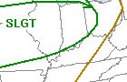
The Storm Prediction Center has placed areas just north and west of Louisville under a Slight Risk for severe weather today in light of the MCS making its way through.
More storms are possible tomorrow afternoon as a cold front nears the Ohio River. We're under another Slight Risk for severe storms tomorrow, but my thinking is that Southern Kentucky will be under the greatest threat as instability increases tomorrow ahead of the southeastward advancing cold front.

Heavy rain will again be the biggest risk around here tomorrow as precipitable water numbers will be quite high across the region. We could easily end up with nearly an inch of rain or more by Friday here in Louisville according to the HPC's QPF outlook. Extreme amounts of four inches or more are possible south of St. Louis.


 The Storm Prediction Center has placed areas just north and west of Louisville under a Slight Risk for severe weather today in light of the MCS making its way through.
 Heavy rain will again be the biggest risk around here tomorrow as precipitable water numbers will be quite high across the region. We could easily end up with nearly an inch of rain or more by Friday here in Louisville according to the HPC's QPF outlook. Extreme amounts of four inches or more are possible south of St. Louis.
No comments:
Post a Comment