 |
| Low off the Gulf Coast on Saturday |

Wednesday, April 18, 2012
4/18 - 9pm - Rainy End to the Week?

Saturday, April 14, 2012
4/14 - 2:30pm - Nice West TN Weekend, Outbreak in the Plains
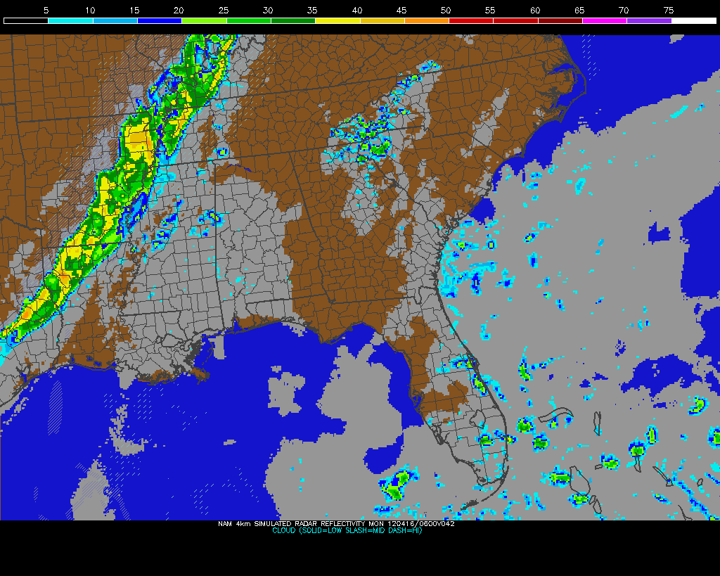 |
| Sunday Night storms on NAM Model |
 A potent severe weather outbreak is just getting started in the Plains right now. Areas from Nebraska to Oklahoma are under a rare High Risk of severe weather from the Storm Prediction Center and violent tornadoes are expected this afternoon and evening. Already we've had quite a few reports of tornadoes touching down and doing damage in Kansas this afternoon, and more of the same can be expected as this system pulls more moisture northward and destabilization continues. On the left you'll see the latest EHI chart from the SPC, which is a measure of helicity (spinning motion in the atmosphere) and instability. This is a decent indicator of where the strongest tornadoes could form. It's really ramping up with values as high as 7 in Oklahoma right now, but those values are expected to increase and possibly move northward this afternoon and evening into Kansas and Nebraska.
Be sure and join me again on WBBJ for 7 Eyewitness News at 6 and 10pm tonight!
Thursday, April 12, 2012
4/12 - 5pm - Louisville Heat Island Research
 It's finished. Since January I've been working on a bit of research that seeks to explain roughly how much the urban heat island effect is skewing the temperatures at Louisville International Airport (KSDF) compared to the rest of the city. Even though I completed this paper for honors credit in my applied climatology class at Mississippi State, this is a project I've been wanting to undertake since my high school years. (See update at bottom of post)

 |
| Louisville International Airport |

UPDATE: Mark Jarvis, senior forecaster at NWS Louisville, emailed with information saying that the temperature sensor at KSDF was changed in June 2011 and apparently the anomaly between KSDF temperatures and those in surrounding areas is not as great as it once was due to this. A study will be conducted by the NWS this summer to see how the sensor is performing. This does not change the 2009-2010 data and results I obtained in my paper above.
Wednesday, April 11, 2012
4/11 - 4pm - Quiet Weather Ahead, Storms in the Plains


 Speaking of storms, the Plains has a risk of severe weather every day this week through Saturday. Persistent southwest flow aloft coupled with a few shortwave disturbances and eventually a big trough moving through later this week should trigger severe storms in quite a few locations in Tornado Alley. Right now there's a Tornado Watch out for the Texas Panhandle up through Southeast Colorado because of a stalled surface front that is providing a focus for storm development. A supercell that has popped up just north of Amarillo is providing quite a show on radar but has not put down a tornado yet according to the National Weather Service. The risks for severe weather out in that part of the nation will likely become more elevated as the bigger trough moves through later this week. In less than 24 days I'll be traveling the Plains again with Storm Chasing Adventure Tours in my 5th year of being a tour guide with them. I can't wait!
Saturday, April 7, 2012
4/7 - 7:15pm - Fantastic Easter Weekend

Wednesday, April 4, 2012
4/4 - 3pm - Are the Storms Scared of Starkville?
 |
| Fast-moving outflow boundary at MSU on Monday |
 |
| Tomorrow's SPC severe weather risk |
Saturday, March 31, 2012
3/31 - 3pm - Severe Risk in West Tennessee
 Storms are already popping up in Tennessee as a weak disturbance aloft is allowing the warm, moist air that we have at the surface to rise. A Severe Thunderstorm Watch is in effect for a good deal of West Tennessee until 9pm CDT tonight and the main risks from these storms should they become severe will be large hail and wind. With temperatures aloft being so cold the storms should be able to produce hail easily today. Might want to think about putting your car in a garage or carport if you have one.
 Instability is already building across the region as you'll see on the right image. Storms have not really broken out across West Tennessee yet because a weak warm layer aloft known as the "cap" is prohibiting air from rising. Once we get a degree or so warmer that cap should erode and storms will form. This will not be a tornado day because wind shear is very, very weak.
Check out my forecast from this morning on WBBJ below:
Be sure and catch me on 7 Eyewitness News again this evening at 6 and 10 o'clock!
Subscribe to:
Posts (Atom)