I'm back home in Louisville after a long drive from Mississippi last night. My third semester at MSU is over after going through my final exams and now it's time to move on to more important things, like a potential accumulating snow here in Louisville this weekend!
The Latest

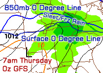
The computer forecast models have had a very difficult time trying to forecast this weekend's storm across the Upper Midwest and Ohio Valley. Earlier this week there were vast differences in where the low pressure center of this storm would track. Some models had the low moving into central Tennessee or central Kentucky before cutting northward to Ohio/West Virginia, and others had it moving into Wisconsin, Illinois, and Indiana before cutting north to the Great Lakes. The Tennessee/Kentucky track is the one that would give Louisville a snowstorm, but it appears a more northerly track will take place. The HPC's (Hydrometeorological Prediction Center) depiction of the northern track is on the right image. Luckily, for you snowlovers out there, this is not the end of our snow chances for this storm here in Kentuckiana!

As the cold air behind this storm catches up with the back end of the rain we'll see on Saturday, we may see a brief burst of wet snow on Saturday night. Then, light snow will wrap around the back end of the storm and impact us from the north on Sunday, possibly into Monday. By the time this is all said and done, I think Louisville will have 2-3" (isolated 4") of snow on the ground with lower amounts south and higher amounts north of here. The 6z GFS model seems to be picking up on these totals well and I've posted its forecast snowfall accumulation map to the left. You can click the image for a larger view if needed.
Here's what the National Weather Service in Louisville says about all of this:
THE COLD FRONT LOOKS TO PUSH THROUGH THE AREA SATURDAY EVENING BEFORE MIDNIGHT OVER MOST LOCATIONS. DEPENDING ON HOW FAST THE COLD AIR CAN CATCH UP TO THE PRECIP...THERE MAY BE A BRIEF CHANGE OVER TO SNOW ESPECIALLY IN THE BLUEGRASS BEFORE WE GET INTO A BRIEF DRY SLOT EARLY SUNDAY MORNING. WRAP AROUND LIGHT SNOW WILL THEN PUSH THROUGH THE AREA ON SUNDAY. LAKE ENHANCED LIGHT SNOW WILL CONTINUE SUNDAY NIGHT THROUGH MONDAY BECOMING MORE CONFINED TO OUR SOUTHEAST INDIANA COUNTIES AND THE BLUEGRASS BY MONDAY AS MOISTURE SLOWLY PULLS AWAY FROM THE REGION. TOTAL SNOW ACCUMS LOOK TO BE BETWEEN 1-3 INCHES FROM SAT NIGHT THROUGH MONDAY WITH THE HIGHEST ACCUMS EXPECTED OVER SOUTHEAST INDIANA AND THE BLUEGRASS REGION.
Even though we have a general track somewhat ironed out now, there are a couple of details that could increase our snow totals. While the GFS/ECMWF (European)/NAM/CMC models all generally agree on a northern track to this storm, the UKMET model is still taking a more southerly track near the Ohio Valley. At this point I think it's an outlier solution, but nevertheless there is a sliver of a chance that the low could take a little jog southward and impact our snow totals. There's also a chance that a secondary low could form well to the south of the primary storm and the implications of that are pretty substantial on our snow totals. Chances for that look slim as well as most computer models either don't have it or get rid of it before it exits Texas. Again, these are just a couple little things to watch that could affect us if they come to fruition by some outside chance.

As if the snow wasn't enough, we'll also have to contend with gusty winds of 25-35mph on Sunday which will blow the drier snow around and create visibility issues. Temperatures will also plummet during the storm as a cold front comes through, meaning we'll see highs only in the 20's for Sunday and Monday here in the Metro. Factor those chilly temperatures in with the winds and you've got yourself below zero windchills. That's dangerous weather in itself... stay warm out there!
I'll be posting updates on my
Facebook and
Twitter accounts today if there are any updates.

 My apologies for posting so late today. I didn't expect the recovery time from my wisdom teeth removal procedure this morning to last so long, but I think I'm about 95% back to normal now. Cold temperatures are the big story tonight as clouds continue to clear out of the area and cooler air filters in from the northwest. Low temperatures will hover around 8 degrees early tomorrow morning and we're already well into the teens at the eleven o'clock hour here in Louisville. Check out some of the surface observations on the image to the right. Indianapolis and Evansville, IN are coming in at 9 degrees at the moment with temperatures getting even closer to 0 as you make your way toward Peoria, IL. Wind chill values will get a few degrees below zero tonight, especially in the suburbs of Jefferson and surrounding counties.