100 degrees might not be that far off as high pressure has settled into the eastern half of the country. As it draws up warm, moist air from the south over the next couple days, temperatures and heat index values will skyrocket. The National Weather Service in Louisville has issued a Heat Advisory from noon to 7pm for both tomorrow and Saturday in lieu of the heat and humidity. Temperatures both tomorrow and Saturday could get very close to 100 degrees and even hit it in areas influenced by the urban heat island effect (like downtown Louisville and the larger suburbs). As dew points get into the lower to mid 70's, heat index values will surge past 100 or even 105 over the next couple days. In other words, be careful and stay hydrated if you have to go outside anytime soon!
Relief will come in the form of a front on Sunday, which should bring us a chance for thunderstorms until Monday morning. Temperatures will stay in the lower 90's after that with a small daily chance of rain through the remainder of the workweek.
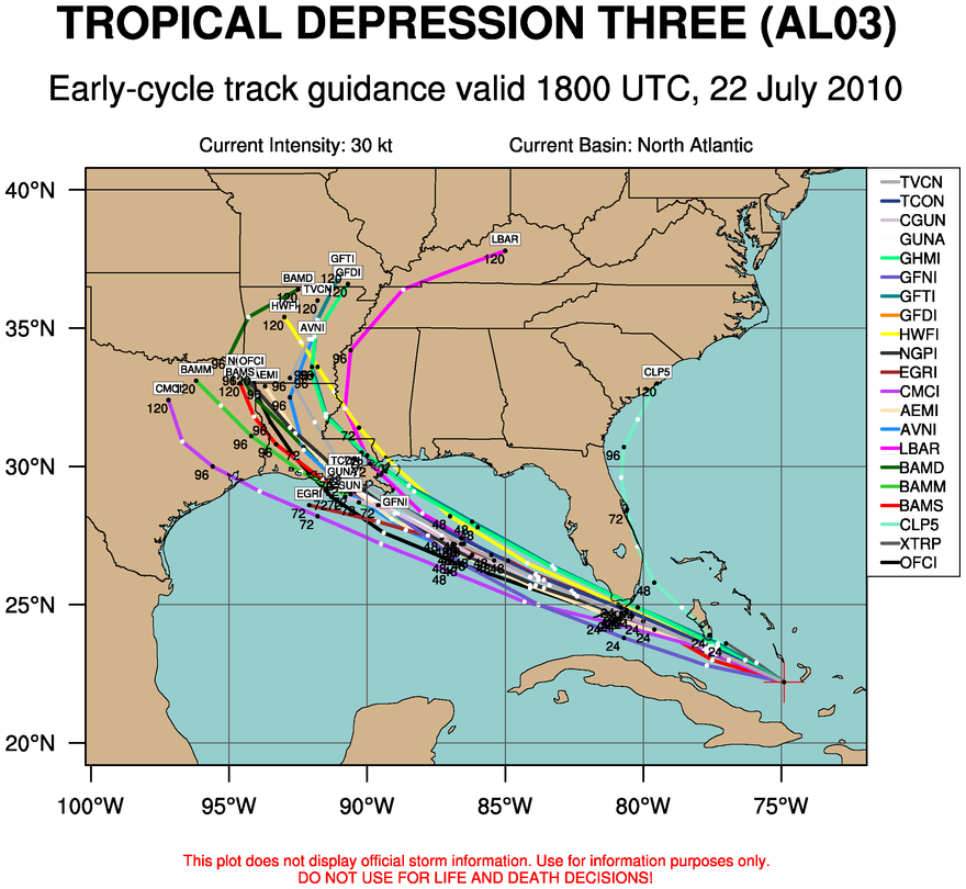
Tropical Storm Bonnie (formerly Tropical Depression Three) has formed off the coast of Florida and is expected to hit the South Florida Coast before heading out to the Gulf of Mexico. It should remain a tropical storm until it makes landfall somewhere near Louisiana according to both the

National Hurricane Center and the spaghetti chart (a compilation of various computer model forecast tracks - see right image). We'll have to keep a close eye on any intensification of this storm, especially when it exits the Florida Peninsula and heads into the Gulf.


 National Hurricane Center and the spaghetti chart (a compilation of various computer model forecast tracks - see right image). We'll have to keep a close eye on any intensification of this storm, especially when it exits the Florida Peninsula and heads into the Gulf.
No comments:
Post a Comment