Saturday, July 28, 2007

7/28 - 10am - No Forecast Video

As you may have seen on the website, Ryan Weather is going to hibernate for a week while I'm out of town. You can still see everything on the site, its just that it won't be updated. I wasn't able to churn out a forecast video this morning because I just ran out of time. I was able to get a graphical forecast out though:


It looks like mid next week is when we turn on the real heat. I don't think a pesky upper level low will cause us problems in the forecast like it did last week. Lucky for me, we don't look like we're going have any severe weather that I would miss out on covering. See you all next week!

Friday, July 27, 2007

7/27 - 3:45pm - Quick storm update...

There's a line of thunderstorms getting ready to hit the Louisville area. There is no severe weather with these storms though. We are under a Severe Thunderstorm Watch, but as of now I don't see any warnings being issued any time soon. Watch out for some small hail and heavy rain in the next hour or so...

I don't think I'll need to do any severe weather broadcasting either, unless this system starts to turn severe. There is some nearly severe weather near Campbellsville, Ky. This stuff contains a better chance for hail and probably a couple microbursts will be thrown in later on today.

7/27 - 9:30am - Hurricanes, Hail, Wind... Uh oh...

I didn't mention this yesterday but it needs mentioning today. On two model runs of the GFS yesterday, a hurricane showed up. It was shown as hitting in between the S. and N. Carolina coasts and being pretty strong. I didn't mention it because I thought that it would probably not show up in later model runs. I've seen the GFS be so finicky before that I figured it was an anomaly and it was also two weeks out.

It showed up on the 0z run this morning again:


This is not to cause alarm, but it is to provide awareness that things are beginning to rev up in the Atlantic. This is still two weeks out and the final solution (if a hurricane even manifests) will probably be way different. The storms that could make this sucker are in western Africa right now and getting ready to exit out to sea. Once these storms go out into the ocean we'll pretty much know if they will form a hurricane or not. Another solution to this hurricane on the 0z run yesterday was just for it to spin harmlessly out to sea. But after seeing two model runs place this thing in the exact same place two weeks out, I'm a little concerned. I read that the GFS predicted hurricane Ernesto back in '03 two weeks out. It was also accurate on the placement of the storm too. So, keep a watch on the tropics.

How about those storms in here this morning? Those were some boomers! Nothing was severe luckily, but we did pick up .3" of rain. Today we could see some severe storms though. The SLIGHT risk for severe weather from yesterday's outlook is unchanged for today. I think the only things we'll have to worry about are hail and wind. Once that's done, should be smooth sailing here for a little while.

Thursday, July 26, 2007

7/26 - 2:20pm - Quite a Subversion...

Just yesterday I was on here rattling on about our severe chances for Saturday afternoon. Today, the SPC erased any chance of severe weather for this time period. Did I get transferred to an alternate universe last night? It seems as if the SPC was really banking on this outbreak and then POOF, its gone. I understand why though...

The GFS killed off the chance for severe weather in the previous couple runs. I think that this chance we had before was dependent on this upper level low doing precisely the right thing at precisely the right time. Since this low is finicky, I think it probably shifted course or speed a little bit and completely wiped out our severe chances for Saturday afternoon. Good news to hear on that end!

Now, there is a SLIGHT risk for severe weather in here for tomorrow, based on the same reasoning as why the Saturday afternoon risk would have occurred. This creped up on me because I was focusing on the Saturday issue, which was advertised as a more prevalent system than this one tomorrow. So now that we're focused on tomorrow, here are the stats:


We're in a 15% zone, which is the low end of a SLIGHT risk (30% being the high one). This will hit late Friday night into early Saturday morning. In effect, there is still a risk for severe weather for Saturday, but its just in the wee hours of the morning instead of the afternoon now. The GFS and NAM want to take the line of thunderstorms a little north of here, but again I don't trust the GFS or NAM for an exact solution to anything, just guidance. So we'll see what happens!

Wednesday, July 25, 2007

7/25 - 10am - Still Looking at Saturday

Here's the latest severe outlook for Saturday (Day 4):


Things have shifted a little south since yesterday's outlook, but we're still in there. Still hard to see whether we'll get the brunt of this system, or any of it at all at this point. I say we'll get some scattered severe storms, but nothing all that bad. We're still a mighty ways out for predicting this kind of event, so keep checking in here for the latest. (I'll be gone starting this Saturday though)

Tuesday, July 24, 2007

7/24 - 2:45pm - The Stage is Set

Elements for a severe weather outbreak around here are suddenly making themselves known. Here's the latest 4-8 day severe weather outlook from our friends at the SPC:


Day 5 (Saturday), is our best chance for this outbreak and the SPC has the area of concern bulls-eyed right over us. Why is this and why is it just coming up now? Well this upper level low that has been giving us the nice cool weather over the past few days is wanting to move west, contrary to normal movement here. A high pressure system in the west is wanting to push east. So the wrestling arena for these two air masses is right here in the Ohio Valley on Saturday. The models say that the upper level low will lose this battle and shift eastward to be absorbed into a larger air mass with similar cyclonic rotation. As the low is absorbed, the high pressure system out west will become unstable due to all of this pushing and mixing of air types. According to the SPC's statement, it seems as if the sheer force of this movement is really going to stir up activity on Saturday.

The answer to why this is just coming up (instead of a week's notice) is because this low pressure system has been very difficult to forecast. If you remember my earlier discussion on tweaking my forecast, then you know that the 90's I forecasted on Saturday for later this week are now totally out of line. It was impossible to tell which way and when this low was going to move. Now that we know that its sticking around for a while longer, so I can pinpoint temps easier. The many unknowns about this low pressure system has shortened the length of long range forecasting accuracy. That's why the severe chances are just being publicized now.

Now, I will be out of town starting on Saturday afternoon. If this thing hits in the early or mid morning, I'll be able to cover it. The GFS paints a morning line of storms over us, but I don't buy it. The last time I trusted the GFS for accurate timing this far out, I ended up looking silly. By Friday I'll be able to see if I will be in town for this and I'll give my final marching orders to everyone on how to prepare for this thing if it looks real bad.

Monday, July 23, 2007

7/23 - 9am - Forecast Changes

If you look at my video forecast and my 7 day forecast you'll notice that there are 90's on there. That will not be the case folks. The upper level low that we are under is now being pushed west by another system in the Atlantic Ocean. That means that for at least another week we will be getting our air from Canada and it will not breach 90 here.

That's not bad news at all! Its interesting how difficult it is to see into the future with forecasting. One minute all the models and your personal calculations are going one way. The next minute an unexpected major change occurs and your forecast is flat wrong. That's meteorology for you!

Saturday, July 21, 2007

7/21 - 12:30pm - New Video Forecast and a Little More...

Well... I've been hard at work creating new graphics for the Ryan Weather video forecast. These are much better looking than the old ones, especially because of the 3D effect. Also, I'm using a new hosing service called Vimeo. This video service is a whole lot better quality than Google Video, so you should be able to see the video better than before.


Also, I made a Ryan Weather commercial and placed it on YouTube (and other sites) to attract more users. I think this will work pretty well...


Friday, July 20, 2007

7/20 - 9pm - Quiet Weather For Now

Whew, what a storm yesterday! It was confirmed today that the PRP area had over 60mph winds caused by a microburst. A microburst is simply a huge down draft of wind that has similar damage characteristics of a tornado. Luckily there were no injuries, but there was some moderate damage left behind.

As far as the forecast goes, no real change from today's weather. Expect temperatures to gently rise through the 80's this week to end in the 90's by late next week. It will be sunny for the week with our next rain chance popping in this time next week.

Thursday, July 19, 2007

7/19 - 7pm - Some Video From Tonight's Coverage

Since this is the first time I've done severe weather coverage, here are a couple of videos from tonight's broadcast. This is to give you an idea of how this broadcast looks for the future. Don't forget to sign up for e-mail severe weather video coverage alerts! Just follow the directions near the bottom of the homepage at http://ryanweather.googlepages.com

Videos:
http://www.ustream.tv/weathergeek/videos/GumksoqgB8U6pDypBxiqPw

http://www.ustream.tv/weathergeek/videos/7nS6qVelx6yPr7UQlxvjVw

7/19 - 6:40pm - Severe Weather Coverage...

Thanks to everyone who watched my severe weather video broadcast this evening. There wasn't too much action around here, so I didn't broadcast too much. Valley Station got hit hard though, with up to 70MPH winds. More later...

7/19 - 5:30pm - Severe T-Storm Watch

As of now we are under a Severe Thunderstorm Watch until 9:00pm. There is a line of thunderstorms getting ready to hit Louisville from the Northeast in just a few minutes. While these storms aren't severe, they are nearing severe limits. Some of the storms in this line are gaining hail signatures on the radar, although the hail doesn't look too bad right now. Another line may perk up tonight after these go through this afternoon. Stay tuned!
Severe T-storm watch just issued for Lou. More info later...

Wednesday, July 18, 2007

7/18 - 5:45pm - Tracking Storms Right Now...

The severe weather that I mentioned in a lengthy post this morning is coming to fruition. A large complex of severe storms has formed in Iowa and is headed towards Louisville. The question is whether this system can make it this far without dissipating. Here's the current radar:

http://i99.photobucket.com/albums/l320/ryanproductions/Ohio_Valley_anim.gif

(Look at the top left near Des Moines for the system to watch)

7/18 - 9:40am - Severe Weather Possible Today...

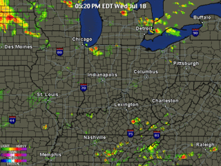
Yesterday, the SPC pulled the SLIGHT risk area north for today's outlook. This morning is a completely different story:


We aren't just on the edge of the risk area today, we're in it. It's interesting because Thursday was supposed to be the big weather climax for this week, but it looks like it might start today. There is little threat for tornadoes, but wind and hail will be issues today. I think today's storms will be in a large, broken line of cells.

As I mentioned earlier, Thursday was supposed to be the big weather day for this week. It still is. We are under a SLIGHT risk again tomorrow for severe weather:


Most forecasts I've peeked at are slapping a 70-80% chance of storms on Thursday (as opposed to 40% for today). The NAM is showing a VERY pronounced line of thunderstorms in here for late Thursday night. It's positioning the heaviest precipitation values near our area too.

This event for tomorrow will start as some scattered heavy thunderstorms ahead of this front. As night descends upon us, I think this line of storms will drive on through with the worst of the weather. When I say worst of the weather, I mean wind and a little bit of hail, nothing too bad. It looks like the indications for hail are weak right now, although this system is proving complex to forecast. Since this will not be a super cell event (scattered HUGE thunderstorms), I agree that hail won't be much of an issue. Since this will be a multicellular event (clusters of t-storms), I think wind will be our primary issue.

Instability won't be all that great tomorrow, but I think the force of the cold front will be enough to get things stirred up...

Tuesday, July 17, 2007

7/17 - 8pm - Wet Weather Ahead?

Just a few days ago it looked like we could have a dry week ahead of us. Fortunately, the models are now leaning towards a more favorable scenario for rain. I think Thursday looks like our breadwinner for rain, possibly up to a third or half of an inch according to the HPC's outlook.

We did have a quick line of strong thunderstorms move through earlier this evening. The power in SE Jefferson County was out for a couple hours, but has since been restored. We picked up about .08" in my neck of the woods...

7/17 - 3:13pm - Stong Storms En Route!

Here's the latest radar image (3:12pm):


Nothing severe heading towards us at this point, but some pretty nasty hail (.5") is embedded in some of these cells.

Monday, July 16, 2007

7/16 - 6:40pm - It's Dry... It's Hot!

This is not a good cycle we're in right now. We've seen just peanuts for rain over the past few days and we're starting to get into an heating trend. The less rain we have, the drier the ground. The drier the ground we get, the hotter it gets. The NAM shows scattered T-storms over the next four days. This means that some will get left out on needed precipitation unfortunately.

But don't feel left out if you don't get any rain this week, we'll all be back to square one next week with a renewed thrust of hot air. I think we could shoot into the mid 90's and even possible touch 100 with this. The GFS really pushes some isobars to the north on this pattern, which isn't good for our purposes.

Quick Tropics Update....

I just peeked at the Hurricane Center's discussions and there seems to be activity in the Carribean Sea and Atlantic. Even though there are no depressions or tropical storms, there are pockets of rotation and convection down there with some moderate thunderstorms. The elements are all there for a storm, so now we just sit and wait.

Thursday, July 12, 2007

7/12 - 9:30am - Lower 80's? In July?

That's right! Tomorrow's high will be 83 degrees. What a relief from all of those 90 degree temperatures we've been hammered with...

Unfortunately we will be dry also, as the parcel of air over us is dry as a bone. With these low temperatures the next couple of days is a price to pay. This bill comes due early next week when we reach 90 and above again. Until then, enjoy the cool weather!

Monday, July 9, 2007

7/9 - 9:30pm - Cooling Off...

This heat has made me sweat today. That combined with the humidity makes even a four mile bike trip seem intolerable. I think we are in need of a break.

We are indeed getting a break, and its starts now! Tomorrow and Wednesday will have great chances for needed rain and temperatures settling down into the mid and lower 80's. That sure sounds a lot better than mid to lower 90's!

Now, about this rain business. Tomorrow should be a light rain, maybe a third of an inch. In contrast Wednesday looks to be a soaker, with over an inch of rain possible. The HPC's precip outlook has been a little squirrelly on this system, but I think we're close enough to make a good assumption. Meanwhile, the NAM continues to agree loosely with HPC's current outlook. Don't you just love it when weather models agree with each other?

After that, we'll have another DRY and HOT week. I think temperatures may reach near the mid or (possibly) even upper 90's then.

Thursday, July 5, 2007

7/5 - 2:25pm - Lightning Show!

At around midnight last night, we had quite a lightning show in the area. Thankfully, most were able to shoot off their own fireworks before the real ones came. I know that I counted at least one strike every minute or so last night, which was quite impressive for a small line of storms like that.

We are still under a SLIGHT risk of severe storms for today, pending that we can scoot the clouds out for some convection. I just took a quick look at the radar and it was showing some small cell development just south of Indianapolis. It looks like the development is on the increase too. Keep in mind that this was the area that was hit by some decent severe weather yesterday. Since the front has moved south, so has the risk area. So that means we might get at least a taste of what the area south of Indy got yesterday, although the SPC favors the Cincinnati area...

Tuesday, July 3, 2007

7/3 - 7pm - SLIGHT Risk on Thursday

The SPC is now calling for a SLIGHT risk of severe storms on Thursday. I see a pretty good chunk of moisture on the GFS still, about the same as Sunday's model run that I discussed. The CAPE model shows adequate instability for a small severe event, so I think the SPC made a good call with the SLIGHT risk issuing.

Sunday, July 1, 2007

7/1 - 9:15pm - Rain Coming, Hold On!

Some areas of Louisville have been left out by our recent scattered rain systems. At my house, we got nearly an inch of rain. We were lucky though, some didn't get nearly that much.

I said in my video forecast that I was slapping a 30% chance of rain on Thursday. This was done because I thought the GFS was being delusional about the amount of rain it was showing. Well, I'm now ready to side with it.

Yesterday, as I looked at the NWS and other agencies' forecasts and then looked at the GFS, things weren't adding up. It seemed like the GFS was really driving in the rain, while human forecasters were backing away from it. But again, the same amount of rain showed up on the model today. When I see good consistency in a model like that, alarm bells go off in my head. So now I'm thinking that we'll have a pretty good chance for rain on Thursday. It seems like others are catching onto this idea too, as their forecasts are showing a greater (40-50%) chance for rain...