
Latest Severe Weather Updates
 A severe weather setup that we see normally in the springtime is about to unfold on this late January night across a large expanse of the Southeast. While not "unprecedented" or "once-in-a-lifetime", this outbreak is going to impact quite a few people and it's important that everyone have what they need to be prepared and safe. This post is mainly for folks in North Mississippi and West Tennessee, but you can figure out pretty well how you'll be affected if you're not in these areas by some of the maps and information below. Everyone needs to be aware of what's going on because this will be happening at a very bad time of night when even the night owls are asleep.
Fast Facts
 A MODERATE Risk of severe weather has been issued by the Storm Prediction Center for the overnight hours in West Tennessee and most of North Mississippi. Tornadoes, damaging winds, and hail are all on the table for these areas as storms move through. Even though places like the Golden Triangle in Mississippi are just outside of the Moderate Risk area I would treat this as if you were in it because these storms are going to be very, very strong still as they move through this region. Please, please, please have a weather radio or smartphone app that's armed and ready to alert you if a Tornado Warning is issued for your location tonight. This will be hitting when most people are asleep so it's a very dangerous situation.
Timing - North MS and West TN
8pm - Midnight - Small chance for some isolated storms. These would carry a tornado, wind, and hail threat.
Midnight - 2am - Slightly better chance for isolated storms, small line of storms may try to form ahead of main line.
2am - 7am - Main line of severe thunderstorms moves through. This will affect everyone. Tornadoes, severe damaging winds, and hail are a good bet during this time.
Discussion
 A line of storms stretches from the Great Lakes to Texas right now and will continue to move eastward through the evening. A few reports of severe weather have come in already from this but the main show will be overnight as this line of storms encounters a more rich environment for severe weather.
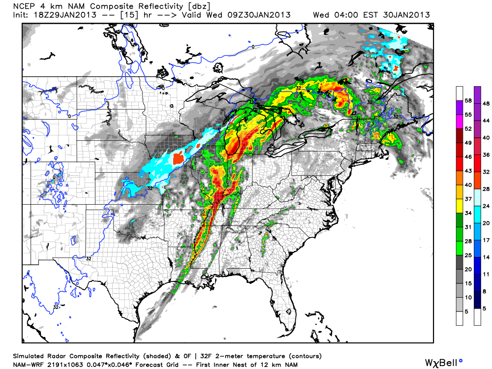 The main storm mode for tonight will be a squall line of storms with embedded rotation in portions of it (AKA what's termed a QLCS). Supercell storms will be possible ahead of the main line of storms too and could easily produce tornadoes if they develop. Tornadoes in QLCS lines of storms like the one we'll have tonight are more difficult to identify on radar since they're embedded within the line. While not as strong as supercell tornadoes, QLCS tornadoes can be strong and cause massive damage in the right environment.
 Also, since winds at 850 mb (about 5,000 feet) will be howling it will not take much for any part of this line of storms to pull these winds down to the surface and create straight-line wind damage. I wouldn't be surprised if folks affected by the worst of these winds thought they were hit by a tornado. I'm hearing the word Derecho being thrown around a bit with regard to how this system will develop tonight. That's certainly a possibility with this system but I think it's a relatively small chance.
Follow me on Twitter and my Facebook page for the latest updates tonight!


